
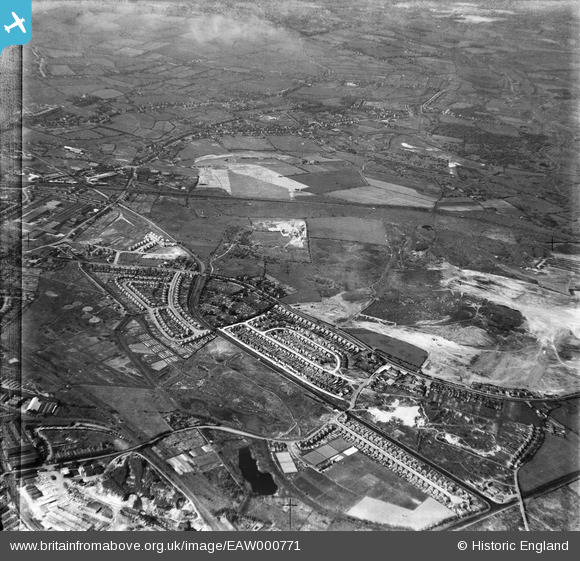
EAW000771 ENGLAND (1946). Wolverhampton Road, Bentley Cemetery and environs, Bentley 1946
© Copyright OpenStreetMap contributors and licensed by the OpenStreetMap Foundation. 2025. Cartography is licensed as CC BY-SA.
Nearby Images (6)
EAW000771

EAW000772

EAW000773

EAW000777

EAW000776

EAW000770

Details
| Title | [EAW000771] Wolverhampton Road, Bentley Cemetery and environs, Bentley 1946 |
| Reference | EAW000771 |
| Date | 11-May-1946 |
| Link | |
| Place name | BENTLEY |
| Parish | |
| District | |
| Country | ENGLAND |
| Easting / Northing | 398107, 299028 |
| Longitude / Latitude | -2.027945141379, 52.588694898471 |
| National Grid Reference | SO981990 |
Pins

redmist |
Monday 10th of October 2022 08:44:38 PM | |
|
Portland |
Monday 12th of October 2020 04:00:14 PM | |
|
Marie |
Sunday 12th of July 2020 08:18:58 PM | |
|
Dave |
Sunday 28th of June 2020 11:13:44 PM | |
|
Bentleyboy |
Friday 4th of April 2014 10:34:56 PM | |
|
Bentleyboy |
Friday 4th of April 2014 10:33:19 PM | |
|
Bentleyboy |
Friday 4th of April 2014 10:32:11 PM | |
|
Bentleyboy |
Friday 4th of April 2014 10:31:39 PM | |
|
Bentleyboy |
Friday 4th of April 2014 10:30:15 PM | |
|
Bentleyboy |
Friday 4th of April 2014 10:29:05 PM | |
|
Bentleyboy |
Friday 4th of April 2014 10:28:05 PM | |
|
Bentleyboy |
Friday 4th of April 2014 10:26:08 PM |