
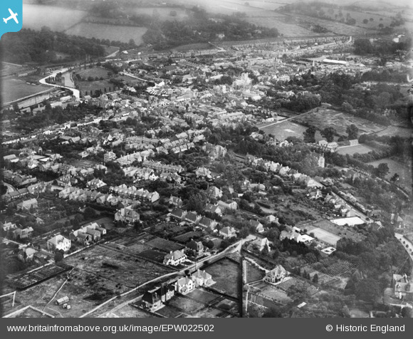
epw022502 ENGLAND (1928). The town, Berkhamsted, from the south-west, 1928
© Hawlfraint cyfranwyr OpenStreetMap a thrwyddedwyd gan yr OpenStreetMap Foundation. 2026. Trwyddedir y gartograffeg fel CC BY-SA.
Manylion
| Pennawd | [EPW022502] The town, Berkhamsted, from the south-west, 1928 |
| Cyfeirnod | EPW022502 |
| Dyddiad | August-1928 |
| Dolen | |
| Enw lle | BERKHAMSTED |
| Plwyf | BERKHAMSTED |
| Ardal | |
| Gwlad | ENGLAND |
| Dwyreiniad / Gogleddiad | 498604, 207640 |
| Hydred / Lledred | -0.5711916667874, 51.758301994482 |
| Cyfeirnod Grid Cenedlaethol | SP986076 |
Pinnau

D Figueiredo |
Wednesday 19th of December 2012 10:22:18 AM | |
|
D Figueiredo |
Wednesday 19th of December 2012 10:19:28 AM | |
|
RichardK |
Wednesday 24th of October 2012 07:49:46 AM |
Cyfraniadau Grŵp
Suspect that this view may be from the North West. St Peters Church may been seen in the middle back ground, it is on the left of the High Street when traveling towards London. The sweep in the road, left back ground is Lower Kings Road that runs over the Grand Union Canal and past the railway station. I lived in Berkhamsted 1953 to 1964, my dad Bob Keeling was a pilot with Huntings and took a number of Aerofilms photographs. Great Site!!!! |
RichardK |
Wednesday 24th of October 2012 07:50:02 AM |