
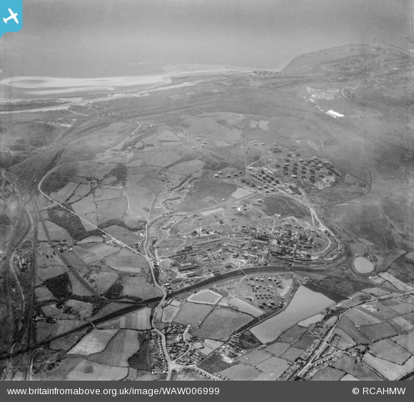
WAW006999 WALES (1947). General view of the Anglo Iranian oil refinery, Llandarcy, with Jersey Marine and Swansea docks in the distance. Oblique aerial photograph, 5½" cut roll film.
© Hawlfraint cyfranwyr OpenStreetMap a thrwyddedwyd gan yr OpenStreetMap Foundation. 2025. Trwyddedir y gartograffeg fel CC BY-SA.
Delweddau cyfagos (48)
WAW005772

WAW005773

WAW005774

WAW005776

WAW005777

WAW005778

WAW005779

WAW005780

WAW005781

WAW006989

WAW007000

WAW007001

WAW039160

WAW039161

WAW039162

WAW039163

WAW039164

WAW039165

WAW039166

WAW039167

WAW039168

WAW039169

WAW039170

WAW039171

WAW039172

WAW039173

WAW039174

WAW039175

WPW011954
, oblique aerial view. 5\"x4\" black and white glass plate negative.")
WPW029737

WPW041415

WPW041416

WPW044821
 Llandarcy, oblique aerial view. 5\"x4\" black and white glass plate negative.")
WPW044822
 Llandarcy, oblique aerial view. 5\"x4\" black and white glass plate negative.")
WPW044823
 Llandarcy, oblique aerial view. 5\"x4\" black and white glass plate negative.")
WPW044824
 Llandarcy, oblique aerial view. 5\"x4\" black and white glass plate negative.")
WPW044825
 Llandarcy, oblique aerial view. 5\"x4\" black and white glass plate negative.")
WPW044826
 Llandarcy, oblique aerial view. 5\"x4\" black and white glass plate negative.")
WPW044827
 Llandarcy, oblique aerial view. 5\"x4\" black and white glass plate negative.")
WPW044828
 Llandarcy, oblique aerial view. 5\"x4\" black and white glass plate negative.")
WPW044829
 Llandarcy, oblique aerial view. 5\"x4\" black and white glass plate negative.")
WPW044830
 Llandarcy, oblique aerial view. 5\"x4\" black and white glass plate negative.")
WPW044831
 Llandarcy, oblique aerial view. 5\"x4\" black and white glass plate negative.")
WPW044832
 Llandarcy, oblique aerial view. 5\"x4\" black and white glass plate negative.")
WPW044833
 Llandarcy, oblique aerial view. 5\"x4\" black and white glass plate negative.")
WPW044834
 Llandarcy, oblique aerial view. 5\"x4\" black and white glass plate negative.")
WPW044835
 Llandarcy, oblique aerial view. 5\"x4\" black and white glass plate negative.")
WPW044836
 Llandarcy, oblique aerial view. 5\"x4\" black and white glass plate negative.")
Manylion
| Pennawd | [WAW006999] General view of the Anglo Iranian oil refinery, Llandarcy, with Jersey Marine and Swansea docks in the distance. Oblique aerial photograph, 5½" cut roll film. |
| Cyfeirnod | WAW006999 |
| Dyddiad | 1947 |
| Dolen | Coflein Archive Item 6422817 |
| Enw lle | |
| Plwyf | |
| Ardal | |
| Gwlad | WALES |
| Dwyreiniad / Gogleddiad | 271000, 195500 |
| Hydred / Lledred | -3.8645437152259, 51.643017681742 |
| Cyfeirnod Grid Cenedlaethol | SS710955 |
Pinnau

Nigel_Wassell |
Tuesday 28th of March 2023 02:20:41 PM | |
|
Nigel_Wassell |
Tuesday 28th of March 2023 02:20:06 PM | |
|
Nigel_Wassell |
Tuesday 28th of March 2023 02:18:17 PM | |
|
Nigel_Wassell |
Tuesday 28th of March 2023 02:17:32 PM | |
|
Nigel_Wassell |
Tuesday 28th of March 2023 02:16:51 PM | |
|
Nigel_Wassell |
Tuesday 28th of March 2023 02:16:28 PM | |
|
Nigel_Wassell |
Tuesday 28th of March 2023 02:14:57 PM | |
|
Nigel_Wassell |
Tuesday 28th of March 2023 02:13:59 PM | |
|
Nigel_Wassell |
Tuesday 28th of March 2023 02:12:59 PM | |
|
Nigel_Wassell |
Tuesday 28th of March 2023 02:12:26 PM | |
|
Nigel_Wassell |
Tuesday 28th of March 2023 02:11:13 PM | |
|
Ken Evans |
Wednesday 23rd of August 2017 07:51:04 PM |
Cyfraniadau Grŵp
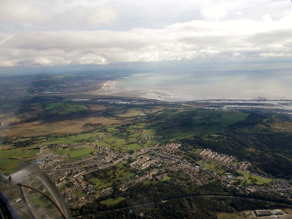
Aerial view taken from above Briton Ferry showing Baglan Bay, Swansea Docks and The Mumbles. We are looking south west. 9th October 2013. Courtesy Con Shields |

Class31 |
Tuesday 6th of January 2015 08:36:55 AM |
Aerial view of King's Dock and Queen's Dock from the North, October 2013, Courtesy Con Shields |
Class31 |
Tuesday 6th of January 2015 08:30:20 AM |
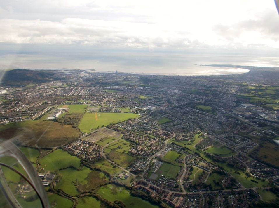
Aerial view from above Fforestfach looking south towards Swansea Docks and the Mumbles, 9th October 2013. Courtesy Con Shields |
Class31 |
Tuesday 6th of January 2015 08:29:07 AM |
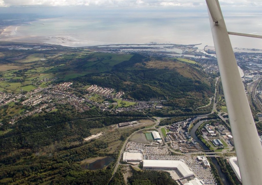
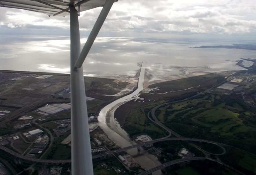
Aerial view of Swansea Docks and Baglan Bay looking south east, 9th October 2013. Courtesy Con Shields Morfa Shopping Centre and River Tawe in the foreground. |
Class31 |
Tuesday 6th of January 2015 08:26:38 AM |
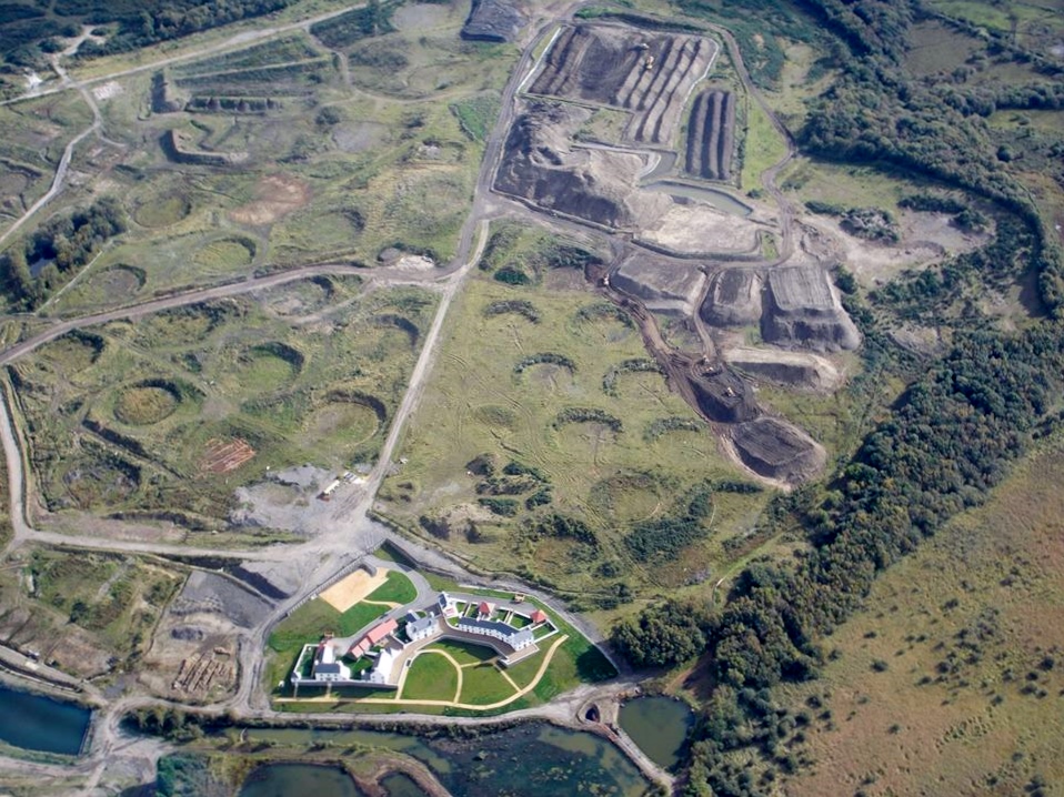
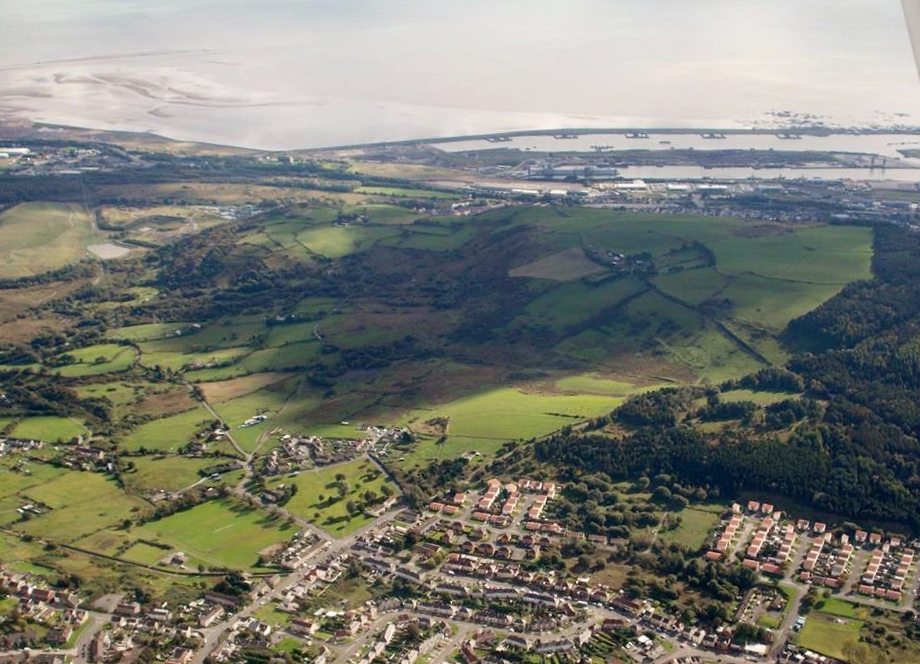
An aerial view of Llandarcy showing circular depressions where oil tanks have been removed, 9th October 2013. Courtesy Con Shields |
Class31 |
Tuesday 6th of January 2015 08:22:21 AM |
Aerial view of Swansea Docks and Baglan Bay looking south east, October 2013. Courtesy Con Shields |
Class31 |
Monday 5th of January 2015 09:16:05 AM |