
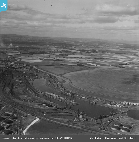
SAW018839 SCOTLAND (1948). Grangemouth, general view, showing Grange Dock and Skinflats. An oblique aerial photograph taken facing north-west. This image has been produced from a print.
© Hawlfraint cyfranwyr OpenStreetMap a thrwyddedwyd gan yr OpenStreetMap Foundation. 2026. Trwyddedir y gartograffeg fel CC BY-SA.
Manylion
| Pennawd | [SAW018839] Grangemouth, general view, showing Grange Dock and Skinflats. An oblique aerial photograph taken facing north-west. This image has been produced from a print. |
| Cyfeirnod | SAW018839 |
| Dyddiad | 1948 |
| Dolen | NRHE Collection item 1314881 |
| Enw lle | |
| Plwyf | GRANGEMOUTH |
| Ardal | FALKIRK |
| Gwlad | SCOTLAND |
| Dwyreiniad / Gogleddiad | 291440, 683170 |
| Hydred / Lledred | -3.7422227203133, 56.029159992707 |
| Cyfeirnod Grid Cenedlaethol | NS914832 |
Pinnau
Byddwch y cyntaf i ychwanegu sylw at y ddelwedd hon!