
EPW062230 ENGLAND (1939) [Unlocated]. UNLOCATED. This image has been produced from a print.
© Hawlfraint cyfranwyr OpenStreetMap a thrwyddedwyd gan yr OpenStreetMap Foundation. 2026. Trwyddedir y gartograffeg fel CC BY-SA.
Delweddau cyfagos (48)
EPW000143

EPW000667

EPW005260

EPW006389
, 1921")
EPW007181

EPW015853

EPW015854

EPW015855

EPW016012

EPW016510

EPW016641

EPW017028

EPW017029

EPW017136

SAW003585

SAW003586

SAW009337

SAW009800

SAW009801

SAW009802

SAW010734

SAW014737

SAW017926

SAW017927

SAW032504

SPW020275

SPW020280

SPW020281

SPW020284

SPW020632

SPW020633

SPW027083

SPW049776

SPW049777

SPW049779

SPW049783

SPW049791

SPW049798

SPW049801

SPW049827

SPW049828

SPW049831

SPW049832

SPW049834

SPW049948

SPW049949

SPW051009

SPW062638

Manylion
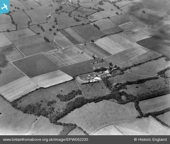
| Pennawd | [EPW062230] UNLOCATED. This image has been produced from a print. |
| Cyfeirnod | EPW062230 |
| Dyddiad | 25-July-1939 |
| Dolen | |
| Enw lle | |
| Plwyf | |
| Ardal | |
| Gwlad | ENGLAND |
| Dwyreiniad / Gogleddiad | 0, 0 |
| Hydred / Lledred | -7.556448482059, 49.766185796754 |
| Cyfeirnod Grid Cenedlaethol | SV000000 |
Pinnau

Dylan Moore |
Friday 4th of December 2015 04:50:25 PM | |
|
Dylan Moore |
Friday 4th of December 2015 04:49:57 PM | |
|
Dylan Moore |
Friday 4th of December 2015 04:45:03 PM | |
|
Dylan Moore |
Friday 4th of December 2015 04:44:34 PM |
Cyfraniadau Grŵp
Image located 4/12/2015. |
Dylan Moore |
Friday 4th of December 2015 07:00:23 PM |
Well Spotted Dylan |

Dave Brunt |
Friday 4th of December 2015 07:00:23 PM |
EPW062232 is of New North Road and environs, Fairlop, 1939 taken 25th July 1939 |

Class31 |
Wednesday 3rd of December 2014 11:48:20 AM |
See also EPW062217 same farm |
TomRobin |
Thursday 6th of November 2014 09:28:45 AM |
Judging by the shadowing the escarpment is south facing. This could restrict it to the North Downs or south slopes of salisbury plan. |
TomRobin |
Monday 3rd of November 2014 07:54:48 PM |
A small chalk or limestone escarpment |
TomRobin |
Monday 3rd of November 2014 07:51:29 PM |