
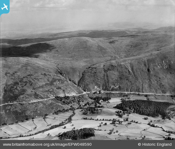
EPW048590 ENGLAND (1935). Chapel Hill, Mardale Common, 1935
© Hawlfraint cyfranwyr OpenStreetMap a thrwyddedwyd gan yr OpenStreetMap Foundation. 2026. Trwyddedir y gartograffeg fel CC BY-SA.
Manylion
| Pennawd | [EPW048590] Chapel Hill, Mardale Common, 1935 |
| Cyfeirnod | EPW048590 |
| Dyddiad | July-1935 |
| Dolen | |
| Enw lle | MARDALE COMMON |
| Plwyf | SHAP RURAL |
| Ardal | |
| Gwlad | ENGLAND |
| Dwyreiniad / Gogleddiad | 348253, 511521 |
| Hydred / Lledred | -2.7990514698353, 54.496242089667 |
| Cyfeirnod Grid Cenedlaethol | NY483115 |
Pinnau

Class31 |
Saturday 4th of May 2013 10:38:07 PM | |
|
Class31 |
Saturday 4th of May 2013 10:37:30 PM | |
|
Class31 |
Saturday 4th of May 2013 10:35:11 PM | |
|
Class31 |
Saturday 4th of May 2013 10:34:40 PM | |
|
Class31 |
Saturday 4th of May 2013 10:34:03 PM | |
|
Class31 |
Saturday 4th of May 2013 10:24:33 PM | |
|
Class31 |
Saturday 4th of May 2013 10:23:37 PM | |
|
Class31 |
Saturday 4th of May 2013 10:21:16 PM |
Cyfraniadau Grŵp
Thank you... The original Aerofilms Ltd Register entry for the image says "Areas in the Lake District for Manchester Corporation Waterworks"; as you know we simply don't have enough leeway with our time to be able to hunt images like this out. It makes such a difference that website members can help with these. We'll update the catalogue and post the new record here in due course. Yours, Katy Britain from Above Cataloguing Team Leader |
Katy Whitaker |
Tuesday 2nd of July 2013 01:11:29 PM |
View looking south east over the valley to be drowned by Haweswater Reservoir and towards Selside Pike. Eureka |
Class31 |
Saturday 4th of May 2013 10:33:23 PM |