
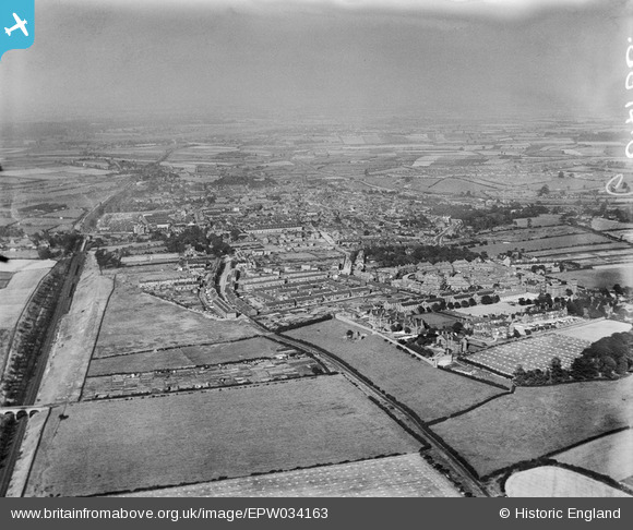
EPW034163 ENGLAND (1930). The city and surrounding countryside, Pontefract, from the south-west, 1930
© Hawlfraint cyfranwyr OpenStreetMap a thrwyddedwyd gan yr OpenStreetMap Foundation. 2026. Trwyddedir y gartograffeg fel CC BY-SA.
Manylion
| Pennawd | [EPW034163] The city and surrounding countryside, Pontefract, from the south-west, 1930 |
| Cyfeirnod | EPW034163 |
| Dyddiad | July-1930 |
| Dolen | |
| Enw lle | PONTEFRACT |
| Plwyf | |
| Ardal | |
| Gwlad | ENGLAND |
| Dwyreiniad / Gogleddiad | 444308, 421377 |
| Hydred / Lledred | -1.3290109844454, 53.686737414984 |
| Cyfeirnod Grid Cenedlaethol | SE443214 |
Pinnau

Derekdye |
Tuesday 15th of January 2013 08:32:29 PM | |
|
Derekdye |
Tuesday 15th of January 2013 08:32:29 PM | |
|
Derekdye |
Tuesday 15th of January 2013 08:31:32 PM | |
|
Derekdye |
Tuesday 15th of January 2013 08:30:25 PM | |
|
Derekdye |
Tuesday 15th of January 2013 08:29:53 PM |