
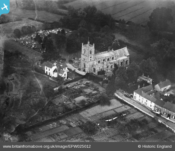
EPW025012 ENGLAND (1928). St Mary's Church, Churchend, 1928. This image has been produced from a damaged negative.
© Hawlfraint cyfranwyr OpenStreetMap a thrwyddedwyd gan yr OpenStreetMap Foundation. 2026. Trwyddedir y gartograffeg fel CC BY-SA.
Manylion
| Pennawd | [EPW025012] St Mary's Church, Churchend, 1928. This image has been produced from a damaged negative. |
| Cyfeirnod | EPW025012 |
| Dyddiad | 9-October-1928 |
| Dolen | |
| Enw lle | CHURCHEND |
| Plwyf | GREAT DUNMOW |
| Ardal | |
| Gwlad | ENGLAND |
| Dwyreiniad / Gogleddiad | 562927, 222960 |
| Hydred / Lledred | 0.36739260703602, 51.880925589998 |
| Cyfeirnod Grid Cenedlaethol | TL629230 |
Pinnau
Byddwch y cyntaf i ychwanegu sylw at y ddelwedd hon!