
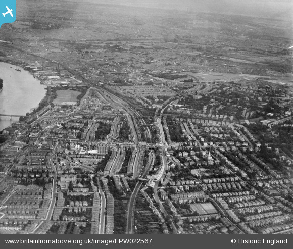
EPW022567 ENGLAND (1928). Upper Richmond Road and environs, Wandsworth, from the west, 1928
© Hawlfraint cyfranwyr OpenStreetMap a thrwyddedwyd gan yr OpenStreetMap Foundation. 2026. Trwyddedir y gartograffeg fel CC BY-SA.
Manylion
| Pennawd | [EPW022567] Upper Richmond Road and environs, Wandsworth, from the west, 1928 |
| Cyfeirnod | EPW022567 |
| Dyddiad | 7-August-1928 |
| Dolen | |
| Enw lle | WANDSWORTH |
| Plwyf | |
| Ardal | |
| Gwlad | ENGLAND |
| Dwyreiniad / Gogleddiad | 523736, 175124 |
| Hydred / Lledred | -0.21867027964887, 51.461060101344 |
| Cyfeirnod Grid Cenedlaethol | TQ237751 |
Pinnau

Leslie B |
Sunday 8th of October 2017 03:20:48 PM | |

Class31 |
Monday 24th of September 2012 02:22:10 PM | |
|
Class31 |
Monday 24th of September 2012 02:21:40 PM | |
|
Class31 |
Monday 24th of September 2012 02:20:08 PM | |
|
Class31 |
Monday 24th of September 2012 02:18:55 PM | |
|
rmarah |
Thursday 28th of June 2012 06:13:02 PM |