
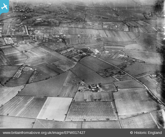
EPW017427 ENGLAND (1927). Northenden Road and environs, Sale, 1927
© Hawlfraint cyfranwyr OpenStreetMap a thrwyddedwyd gan yr OpenStreetMap Foundation. 2026. Trwyddedir y gartograffeg fel CC BY-SA.
Manylion
| Pennawd | [EPW017427] Northenden Road and environs, Sale, 1927 |
| Cyfeirnod | EPW017427 |
| Dyddiad | 8-March-1927 |
| Dolen | |
| Enw lle | SALE |
| Plwyf | |
| Ardal | |
| Gwlad | ENGLAND |
| Dwyreiniad / Gogleddiad | 380834, 390929 |
| Hydred / Lledred | -2.2883869939864, 53.414559788132 |
| Cyfeirnod Grid Cenedlaethol | SJ808909 |
Pinnau

Nick |
Wednesday 15th of April 2026 04:30:27 PM | |
|
calisto751 |
Thursday 16th of February 2023 04:17:15 PM | |
|
John Ellis |
Friday 14th of September 2012 06:02:16 PM | |
|
John Ellis |
Friday 14th of September 2012 05:59:58 PM | |
|
John Ellis |
Friday 14th of September 2012 05:59:14 PM | |
|
John Ellis |
Friday 14th of September 2012 05:58:29 PM | |
Essex Road is actually the very top of Norris Road - there's two old terraces "Ada Terrace" and "Edwin Terrace". Sandford Road is slightly further along. |
elliston75 |
Saturday 15th of August 2015 01:38:56 PM |
Essex Road is now the end of Norris Road. Sandford Road is just off Northenden Road. |
calisto751 |
Thursday 16th of February 2023 04:18:46 PM |
|
John Ellis |
Friday 14th of September 2012 05:55:41 PM | |
|
John Ellis |
Friday 14th of September 2012 05:37:06 PM | |
|
John Ellis |
Tuesday 10th of July 2012 09:44:34 PM | |
|
John Ellis |
Tuesday 10th of July 2012 09:43:01 PM | |
|
John Ellis |
Tuesday 10th of July 2012 09:41:50 PM | |
|
John Ellis |
Thursday 5th of July 2012 10:26:19 PM | |
Incorrect placing - but too late to delete! |
John Ellis |
Tuesday 10th of July 2012 09:41:08 PM |
|
John Ellis |
Thursday 5th of July 2012 10:20:58 PM | |
|
John Ellis |
Thursday 5th of July 2012 10:17:51 PM | |
|
John Ellis |
Thursday 5th of July 2012 10:14:45 PM | |
|
John Ellis |
Thursday 5th of July 2012 10:11:39 PM | |
|
John Ellis |
Thursday 5th of July 2012 10:09:15 PM | |
|
John Ellis |
Thursday 5th of July 2012 10:08:36 PM | |
|
John Ellis |
Thursday 5th of July 2012 10:07:31 PM | |
|
John Ellis |
Thursday 5th of July 2012 10:07:02 PM | |
|
John Ellis |
Thursday 5th of July 2012 10:06:06 PM | |
|
John Ellis |
Thursday 5th of July 2012 10:05:23 PM | |
|
John Ellis |
Thursday 5th of July 2012 10:04:10 PM | |
|
John Ellis |
Thursday 5th of July 2012 10:03:09 PM | |
|
John Ellis |
Thursday 5th of July 2012 10:02:18 PM | |
|
John Ellis |
Thursday 5th of July 2012 10:01:38 PM | |
|
John Ellis |
Thursday 5th of July 2012 10:01:04 PM | |
|
John Ellis |
Thursday 5th of July 2012 10:00:12 PM | |
|
John Ellis |
Thursday 5th of July 2012 09:59:18 PM | |
|
John Ellis |
Thursday 5th of July 2012 09:58:20 PM | |
|
John Ellis |
Thursday 5th of July 2012 09:53:44 PM |