
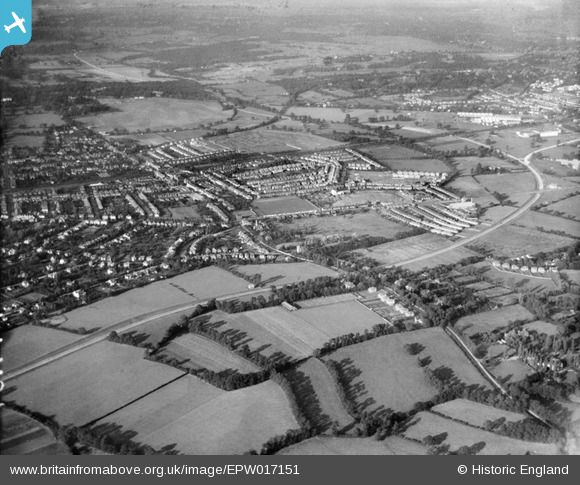
EPW017151 ENGLAND (1926). Malden Hill Gardens and environs, New Malden, from the south-west, 1926
© Hawlfraint cyfranwyr OpenStreetMap a thrwyddedwyd gan yr OpenStreetMap Foundation. 2026. Trwyddedir y gartograffeg fel CC BY-SA.
Manylion
| Pennawd | [EPW017151] Malden Hill Gardens and environs, New Malden, from the south-west, 1926 |
| Cyfeirnod | EPW017151 |
| Dyddiad | October-1926 |
| Dolen | |
| Enw lle | NEW MALDEN |
| Plwyf | |
| Ardal | |
| Gwlad | ENGLAND |
| Dwyreiniad / Gogleddiad | 521342, 167184 |
| Hydred / Lledred | -0.25583731682039, 51.390210241687 |
| Cyfeirnod Grid Cenedlaethol | TQ213672 |
Pinnau

Dom |
Wednesday 30th of August 2023 02:37:05 PM | |
|
New Malden |
Tuesday 28th of June 2016 06:57:15 PM | |
|
New Malden |
Tuesday 28th of June 2016 06:55:27 PM | |
|
New Malden |
Tuesday 28th of June 2016 06:53:31 PM | |
|
New Malden |
Tuesday 28th of June 2016 06:49:28 PM | |
|
New Malden |
Tuesday 28th of June 2016 06:48:00 PM | |
|
mike |
Monday 1st of July 2013 12:50:08 AM | |
|
mike |
Monday 1st of July 2013 12:50:07 AM | |
|
mike |
Monday 1st of July 2013 12:47:47 AM | |
 8-2007.JPG)
Keith |
Thursday 5th of July 2012 07:05:25 PM | |
|
Keith |
Thursday 5th of July 2012 07:03:19 PM | |
|
Keith |
Thursday 5th of July 2012 07:02:49 PM |