
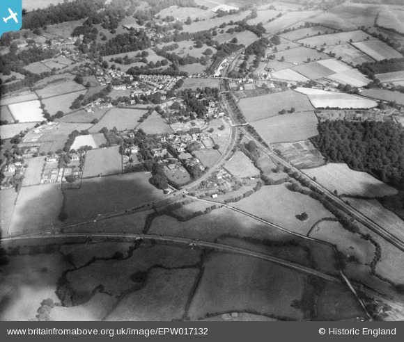
EPW017132 ENGLAND (1926). Withyham Spur and the village, Groombridge, 1926
© Hawlfraint cyfranwyr OpenStreetMap a thrwyddedwyd gan yr OpenStreetMap Foundation. 2026. Trwyddedir y gartograffeg fel CC BY-SA.
Manylion
| Pennawd | [EPW017132] Withyham Spur and the village, Groombridge, 1926 |
| Cyfeirnod | EPW017132 |
| Dyddiad | October-1926 |
| Dolen | |
| Enw lle | GROOMBRIDGE |
| Plwyf | WITHYHAM |
| Ardal | |
| Gwlad | ENGLAND |
| Dwyreiniad / Gogleddiad | 552954, 136643 |
| Hydred / Lledred | 0.18517884726361, 51.108118712918 |
| Cyfeirnod Grid Cenedlaethol | TQ530366 |
Pinnau

ladyceecee |
Saturday 17th of December 2022 03:33:34 PM | |
|
MB |
Sunday 24th of January 2021 03:32:10 PM | |
|
MB |
Sunday 24th of January 2021 03:31:31 PM | |
|
MB |
Sunday 24th of January 2021 03:25:01 PM | |
|
Terry the Carpet Estimator |
Saturday 30th of July 2016 09:22:28 AM | |
|
Tony G |
Wednesday 12th of September 2012 05:07:29 PM |
