
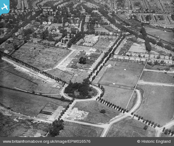
EPW016576 ENGLAND (1926). Circle Gardens and environs, Merton Park, 1926
© Hawlfraint cyfranwyr OpenStreetMap a thrwyddedwyd gan yr OpenStreetMap Foundation. 2026. Trwyddedir y gartograffeg fel CC BY-SA.
Manylion
| Pennawd | [EPW016576] Circle Gardens and environs, Merton Park, 1926 |
| Cyfeirnod | EPW016576 |
| Dyddiad | August-1926 |
| Dolen | |
| Enw lle | MERTON PARK |
| Plwyf | |
| Ardal | |
| Gwlad | ENGLAND |
| Dwyreiniad / Gogleddiad | 525299, 169088 |
| Hydred / Lledred | -0.19831694007922, 51.406463703188 |
| Cyfeirnod Grid Cenedlaethol | TQ253691 |
Pinnau

Mils |
Tuesday 14th of February 2023 02:08:39 PM | |
|
Mils |
Tuesday 14th of February 2023 02:08:17 PM | |
|
Mils |
Tuesday 14th of February 2023 02:07:42 PM | |
|
Arthur |
Friday 22nd of April 2016 12:33:04 PM | |
|
Arthur |
Friday 22nd of April 2016 12:31:23 PM | |
|
Arthur |
Friday 22nd of April 2016 12:30:16 PM | |
|
Arthur |
Friday 22nd of April 2016 12:29:04 PM | |
|
Arthur |
Friday 22nd of April 2016 12:28:41 PM | |
|
Arthur |
Friday 22nd of April 2016 12:27:53 PM | |
|
Arthur |
Friday 22nd of April 2016 12:27:14 PM |
Cyfraniadau Grŵp
Apologies, it looks like the 'C's' were mistaken for a 'G' and 'o' respectively. I've amended the catalogue record for this and EPW016577, the updated records will appear online in due course. Thanks for spotting this. Angharad BfA Cataloguer |
Angharad Wicks |
Friday 6th of December 2013 04:39:06 PM |
This is 'Circle Gardens' NOT 'Girole Gardens' (or at least it is now.) Just to the north of the circle is the Old Rutlishians sports ground on Poplar Road (lined by poplars). |
wessexpig |
Friday 3rd of May 2013 07:50:21 PM |
This is Circle Gardens not Girole Gardens, someone has made a mistake! |
LisadeAzevedo |
Tuesday 26th of June 2012 08:17:41 AM |