
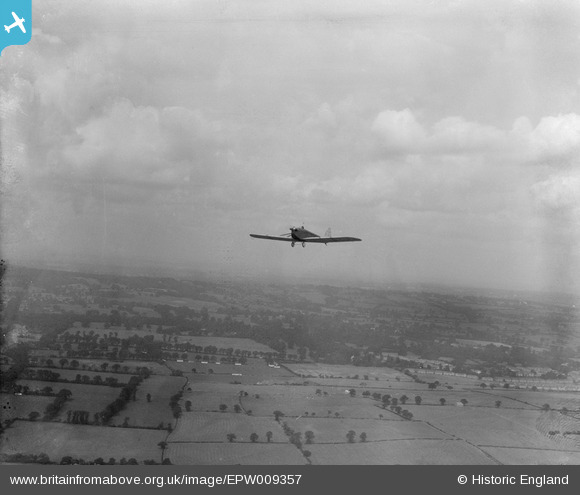
EPW009357 ENGLAND (1923). A DH53 in flight near Honeypot Lane, Little Stanmore, 1923
© Hawlfraint cyfranwyr OpenStreetMap a thrwyddedwyd gan yr OpenStreetMap Foundation. 2026. Trwyddedir y gartograffeg fel CC BY-SA.
Manylion
| Pennawd | [EPW009357] A DH53 in flight near Honeypot Lane, Little Stanmore, 1923 |
| Cyfeirnod | EPW009357 |
| Dyddiad | 1923 |
| Dolen | |
| Enw lle | LITTLE STANMORE |
| Plwyf | |
| Ardal | |
| Gwlad | ENGLAND |
| Dwyreiniad / Gogleddiad | 518581, 190506 |
| Hydred / Lledred | -0.28766584565871, 51.600424140737 |
| Cyfeirnod Grid Cenedlaethol | TQ186905 |
Pinnau

Class31 |
Wednesday 26th of June 2013 09:15:57 AM | |
|
Class31 |
Wednesday 26th of June 2013 09:09:25 AM | |
|
Class31 |
Wednesday 26th of June 2013 09:04:10 AM | |
|
Class31 |
Wednesday 26th of June 2013 09:02:40 AM | |
|
Class31 |
Wednesday 26th of June 2013 09:01:03 AM | |

Dave Brunt |
Monday 24th of June 2013 11:54:13 PM |
Cyfraniadau Grŵp
Eureka I've finally managed to fit the field boundaries in the Stag Lane area. This is a shot looking north with the left hand edge of the photo just to the east of Honeypot Lane. |
Class31 |
Monday 1st of July 2013 01:21:25 PM |
Hi Class31, great spot! We'll update the catalogue, and post the new data here in due course. Yours, Katy Britain from Above Cataloguing Team Leader |
Katy Whitaker |
Monday 1st of July 2013 01:21:25 PM |
The field boundaries can be seen on the 1897 1:10560 OS Middlesex Coordinates around 518780 191180 |
Class31 |
Wednesday 26th of June 2013 08:59:21 AM |