
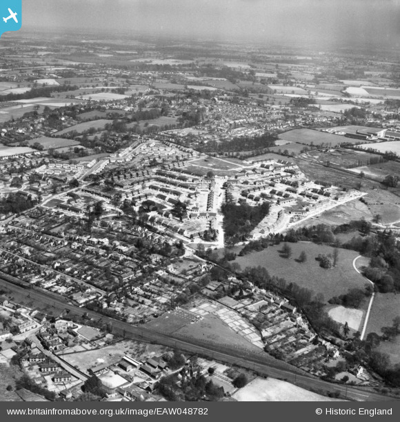
EAW048782 ENGLAND (1953). The residential area surrounding Long Elms, Abbots Langley, from the south-west, 1953
© Hawlfraint cyfranwyr OpenStreetMap a thrwyddedwyd gan yr OpenStreetMap Foundation. 2026. Trwyddedir y gartograffeg fel CC BY-SA.
Manylion
| Pennawd | [EAW048782] The residential area surrounding Long Elms, Abbots Langley, from the south-west, 1953 |
| Cyfeirnod | EAW048782 |
| Dyddiad | 22-April-1953 |
| Dolen | |
| Enw lle | ABBOTS LANGLEY |
| Plwyf | ABBOTS LANGLEY |
| Ardal | |
| Gwlad | ENGLAND |
| Dwyreiniad / Gogleddiad | 508572, 200577 |
| Hydred / Lledred | -0.42901027195421, 51.692970254273 |
| Cyfeirnod Grid Cenedlaethol | TL086006 |
Pinnau

Post-war prefabs |
Monday 13th of January 2020 08:58:34 AM |