
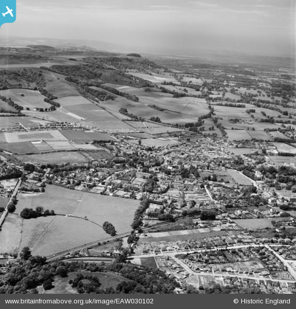
EAW030102 ENGLAND (1950). The town, Steyning, from the east, 1950
© Hawlfraint cyfranwyr OpenStreetMap a thrwyddedwyd gan yr OpenStreetMap Foundation. 2025. Trwyddedir y gartograffeg fel CC BY-SA.
Manylion
| Pennawd | [EAW030102] The town, Steyning, from the east, 1950 |
| Cyfeirnod | EAW030102 |
| Dyddiad | 1-June-1950 |
| Dolen | |
| Enw lle | STEYNING |
| Plwyf | STEYNING |
| Ardal | |
| Gwlad | ENGLAND |
| Dwyreiniad / Gogleddiad | 518128, 110985 |
| Hydred / Lledred | -0.32044847867014, 50.885707103808 |
| Cyfeirnod Grid Cenedlaethol | TQ181110 |
Pinnau

Matt Aldred edob.mattaldred.com |
Friday 2nd of February 2024 02:54:43 PM | |

David960 |
Monday 6th of August 2018 10:59:07 AM | |
|
M Anton |
Monday 28th of May 2018 07:37:11 PM | |
|
M Anton |
Monday 28th of May 2018 07:35:55 PM | |
|
David960 |
Sunday 5th of April 2015 12:15:19 PM | |
|
David960 |
Sunday 5th of April 2015 12:14:56 PM | |
|
David960 |
Sunday 5th of April 2015 12:11:06 PM | |
|
David960 |
Saturday 28th of February 2015 08:21:03 PM | |
|
Biggles1951 |
Thursday 13th of November 2014 06:49:46 PM | |
|
Biggles1951 |
Thursday 13th of November 2014 06:49:00 PM | |
|
Biggles1951 |
Thursday 13th of November 2014 06:46:45 PM | |
|
Biggles1951 |
Thursday 13th of November 2014 06:45:37 PM | |
|
Biggles1951 |
Thursday 13th of November 2014 06:44:22 PM | |
|
Biggles1951 |
Thursday 13th of November 2014 06:43:39 PM |
Cyfraniadau Grŵp
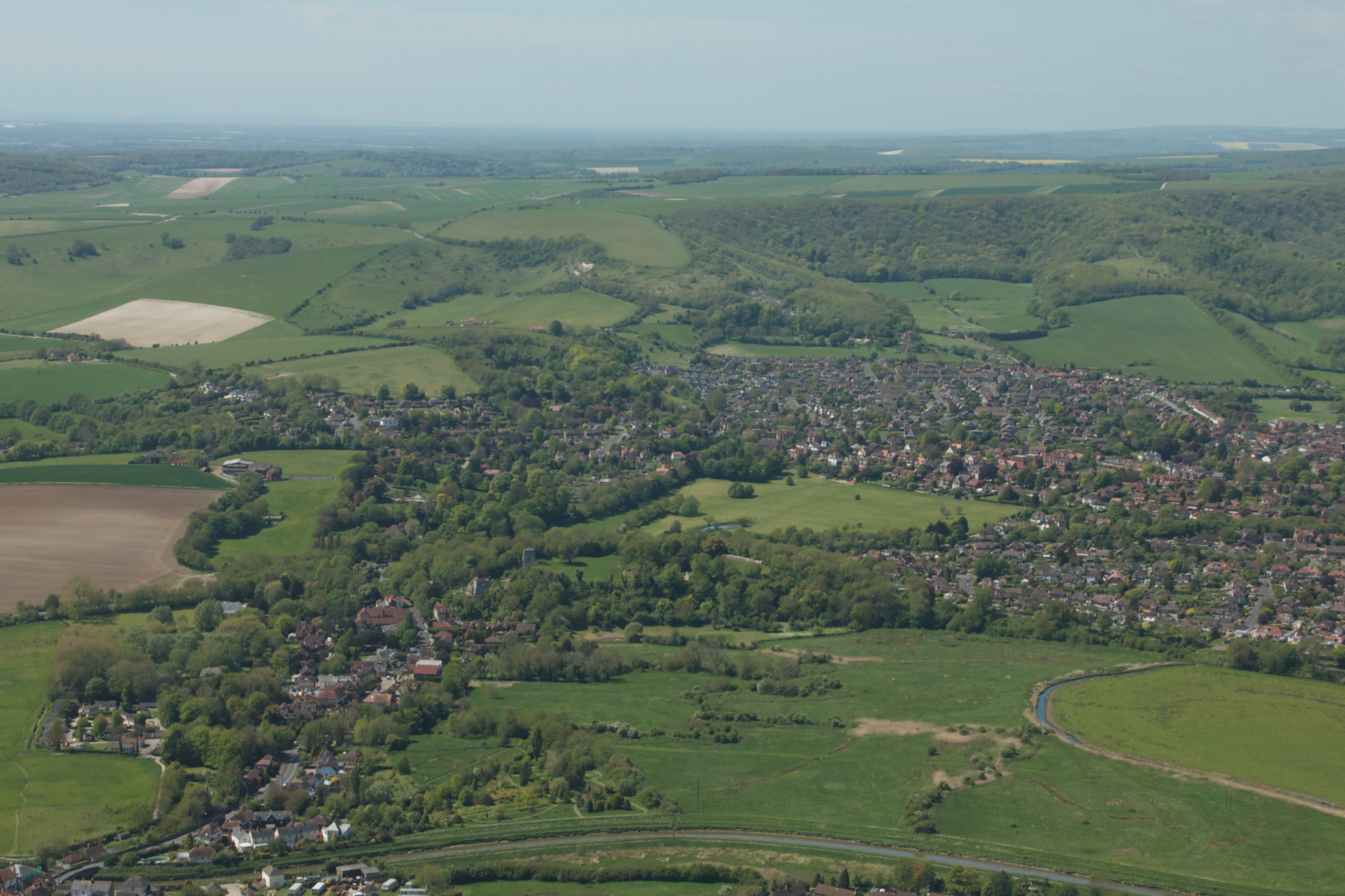
Attached is an aerial photo I took in May 2015. Look at the 1950 picture and note the large recreation ground in the bottom LH quartile of the picture (bounded at the bottom by a railway line and to the left, by a road). Now look at my picture which shows the same recreation ground in the centre of the picture. Note how local trees have become more established, especially on the north escarpment of the South Downs. And notice the abundance of new buildings which have spread out onto the fields which used to be there. |
Biggles1951 |
Thursday 14th of May 2015 03:31:44 PM |