
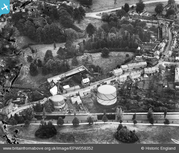
EPW058352 ENGLAND (1938). The town Gas Works between Sherrymill Hill and the Shropshire Union Canal, Whitchurch, 1938. This image has been produced from a damaged negative.
© Copyright OpenStreetMap contributors and licensed by the OpenStreetMap Foundation. 2024. Cartography is licensed as CC BY-SA.
Nearby Images (7)
EPW058352

EPW058348

EPW058347

EPW058349

EPW058350

EPW058351

EPW058395

Details
| Title | [EPW058352] The town Gas Works between Sherrymill Hill and the Shropshire Union Canal, Whitchurch, 1938. This image has been produced from a damaged negative. |
| Reference | EPW058352 |
| Date | 28-July-1938 |
| Link | |
| Place name | WHITCHURCH |
| Parish | WHITCHURCH URBAN |
| District | |
| Country | ENGLAND |
| Easting / Northing | 353866, 341646 |
| Longitude / Latitude | -2.6870272942246, 52.969872314701 |
| National Grid Reference | SJ539416 |
Pins
 Nigel Wilkinson |
Thursday 28th of April 2016 03:59:15 PM |


