
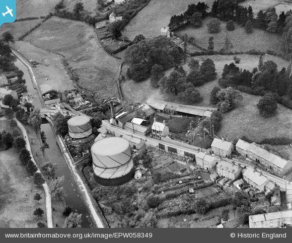
EPW058349 ENGLAND (1938). The town Gas Works between Sherrymill Hill and the Shropshire Union Canal, Whitchurch, 1938
© Copyright OpenStreetMap contributors and licensed by the OpenStreetMap Foundation. 2024. Cartography is licensed as CC BY-SA.
Nearby Images (6)
EPW058349

EPW058348

EPW058347

EPW058351

EPW058352

EPW058350

Details
| Title | [EPW058349] The town Gas Works between Sherrymill Hill and the Shropshire Union Canal, Whitchurch, 1938 |
| Reference | EPW058349 |
| Date | 28-July-1938 |
| Link | |
| Place name | WHITCHURCH |
| Parish | WHITCHURCH URBAN |
| District | |
| Country | ENGLAND |
| Easting / Northing | 353822, 341635 |
| Longitude / Latitude | -2.687680920941, 52.969769640589 |
| National Grid Reference | SJ538416 |
Pins
 BV |
Sunday 9th of March 2014 05:48:33 PM |


