
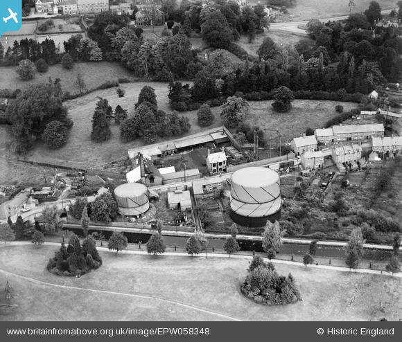
EPW058348 ENGLAND (1938). The town Gas Works between Sherrymill Hill and the Shropshire Union Canal, Whitchurch, 1938
© Copyright OpenStreetMap contributors and licensed by the OpenStreetMap Foundation. 2024. Cartography is licensed as CC BY-SA.
Nearby Images (6)
EPW058348

EPW058347

EPW058349

EPW058352

EPW058351

EPW058350

Details
| Title | [EPW058348] The town Gas Works between Sherrymill Hill and the Shropshire Union Canal, Whitchurch, 1938 |
| Reference | EPW058348 |
| Date | 28-July-1938 |
| Link | |
| Place name | WHITCHURCH |
| Parish | WHITCHURCH URBAN |
| District | |
| Country | ENGLAND |
| Easting / Northing | 353842, 341628 |
| Longitude / Latitude | -2.6873821067963, 52.969708435695 |
| National Grid Reference | SJ538416 |
Pins
Be the first to add a comment to this image!


