
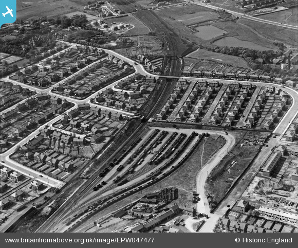
EPW047477 ENGLAND (1935). Railway sidings at Crumpsall Green and environs, Crumpsall, 1935
© Copyright OpenStreetMap contributors and licensed by the OpenStreetMap Foundation. 2024. Cartography is licensed as CC BY-SA.
Nearby Images (13)
EPW047477

EPW047475

EPW046174

EPW017527

EPW047476

EPW048639

EPW048662

EPW048641

EPW046175

EPW048633

EPW048660

EPW047474

EPW048643

Details
| Title | [EPW047477] Railway sidings at Crumpsall Green and environs, Crumpsall, 1935 |
| Reference | EPW047477 |
| Date | May-1935 |
| Link | |
| Place name | CRUMPSALL |
| Parish | |
| District | |
| Country | ENGLAND |
| Easting / Northing | 384010, 402690 |
| Longitude / Latitude | -2.2411974577318, 53.520390317218 |
| National Grid Reference | SD840027 |
Pins
 john |
Tuesday 7th of February 2023 11:10:29 AM |


