
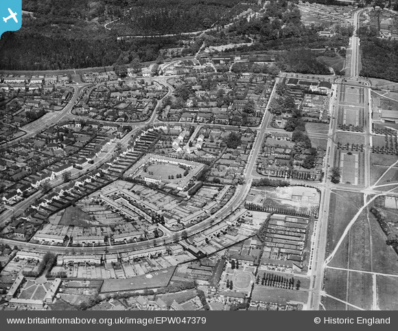
EPW047379 ENGLAND (1935). Guessens Court, Guessens Road and environs, Welwyn Garden City, 1935
© Copyright OpenStreetMap contributors and licensed by the OpenStreetMap Foundation. 2024. Cartography is licensed as CC BY-SA.
Nearby Images (22)
EPW047379

EPW054540

EPW054542

EPW054540A

EPW022030

EPW047357

EPW047367

EPW047356

EPW047369

EPW047368

EPW013424

EAW013992

EPW047376

EPW047377

EPW022018

EAW035461

EPW022027

EPW047366

EPW054531

EPW062075

EPW025536

EPW022026

Details
| Title | [EPW047379] Guessens Court, Guessens Road and environs, Welwyn Garden City, 1935 |
| Reference | EPW047379 |
| Date | May-1935 |
| Link | |
| Place name | WELWYN GARDEN CITY |
| Parish | |
| District | |
| Country | ENGLAND |
| Easting / Northing | 523394, 212953 |
| Longitude / Latitude | -0.21025637356964, 51.801139836832 |
| National Grid Reference | TL234130 |
Pins
Be the first to add a comment to this image!


