
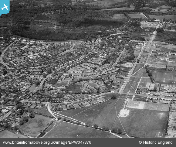
EPW047376 ENGLAND (1935). Handside, Welwyn Garden City, 1935
© Copyright OpenStreetMap contributors and licensed by the OpenStreetMap Foundation. 2024. Cartography is licensed as CC BY-SA.
Nearby Images (19)
EPW047376

EPW047377

EPW054531

EPW054540A

EPW054542

EPW054532

EPW054540

EPW047379

EPW054523

EPW047367

EPW054524

EPW047368

EPW047369

EPW047357

EPW022030

EPW062076

EAW013993

EAW013998

EPW054510

Details
| Title | [EPW047376] Handside, Welwyn Garden City, 1935 |
| Reference | EPW047376 |
| Date | May-1935 |
| Link | |
| Place name | WELWYN GARDEN CITY |
| Parish | |
| District | |
| Country | ENGLAND |
| Easting / Northing | 523314, 212795 |
| Longitude / Latitude | -0.21147231384607, 51.799737436859 |
| National Grid Reference | TL233128 |
Pins
Be the first to add a comment to this image!


