
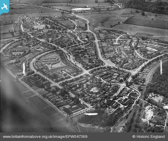
EPW047369 ENGLAND (1935). Handside Lane and environs, Welwyn Garden City, 1935
© Copyright OpenStreetMap contributors and licensed by the OpenStreetMap Foundation. 2024. Cartography is licensed as CC BY-SA.
Nearby Images (18)
EPW047369

EPW047368

EPW047367

EPW054542

EPW054540A

EPW013424

EPW047379

EAW013992

EPW054540

EPW022027

EPW022030

EPW047356

EPW022018

EPW047357

EPW047376

EPW047377

EPW047366

EPW022019

Details
| Title | [EPW047369] Handside Lane and environs, Welwyn Garden City, 1935 |
| Reference | EPW047369 |
| Date | May-1935 |
| Link | |
| Place name | WELWYN GARDEN CITY |
| Parish | |
| District | |
| Country | ENGLAND |
| Easting / Northing | 523284, 213022 |
| Longitude / Latitude | -0.21182646649997, 51.801784251886 |
| National Grid Reference | TL233130 |
Pins
Be the first to add a comment to this image!


