
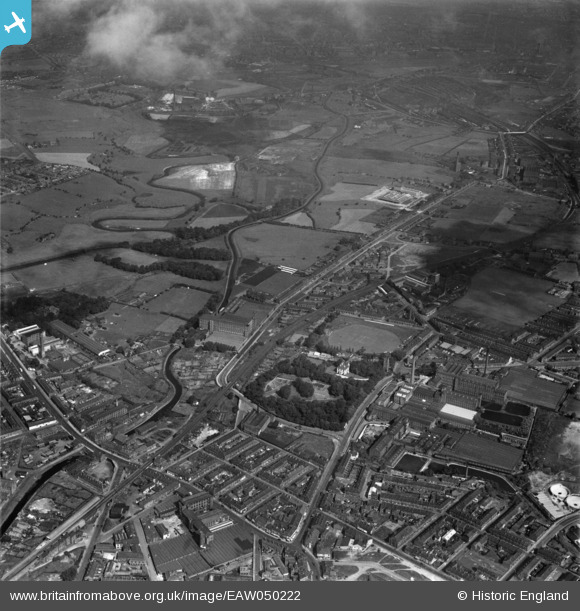
EAW050222 ENGLAND (1953). Throstle Bank Cotton Mill and environs, Hyde, 1953
© Copyright OpenStreetMap contributors and licensed by the OpenStreetMap Foundation. 2024. Cartography is licensed as CC BY-SA.
Nearby Images (21)
EAW050222

EAW050221

EAW050220

EAW050218

EAW038444

EAW038411

EAW038412

EAW038405

EAW050219

EAW038404

EAW038409

EAW038402

EAW050225

EAW038403

EAW038401

EAW050223

EAW038406

EAW050224

EAW038408

EAW038407

EAW038410

Details
| Title | [EAW050222] Throstle Bank Cotton Mill and environs, Hyde, 1953 |
| Reference | EAW050222 |
| Date | 29-June-1953 |
| Link | |
| Place name | HYDE |
| Parish | |
| District | |
| Country | ENGLAND |
| Easting / Northing | 394247, 395645 |
| Longitude / Latitude | -2.0866509920548, 53.457271297484 |
| National Grid Reference | SJ942956 |


