
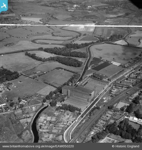
EAW050220 ENGLAND (1953). Throstle Bank Cotton Mill and environs, Hyde, 1953. This image was marked by Aerofilms Ltd for photo editing.
© Copyright OpenStreetMap contributors and licensed by the OpenStreetMap Foundation. 2024. Cartography is licensed as CC BY-SA.
Nearby Images (6)
EAW050220

EAW050219

EAW050221

EAW050218

EAW050222

EAW038412

Details
| Title | [EAW050220] Throstle Bank Cotton Mill and environs, Hyde, 1953. This image was marked by Aerofilms Ltd for photo editing. |
| Reference | EAW050220 |
| Date | 29-June-1953 |
| Link | |
| Place name | HYDE |
| Parish | |
| District | |
| Country | ENGLAND |
| Easting / Northing | 394128, 395570 |
| Longitude / Latitude | -2.0884419524622, 53.456595770561 |
| National Grid Reference | SJ941956 |
Pins
 stardelta |
Thursday 12th of June 2014 02:39:10 PM |


