
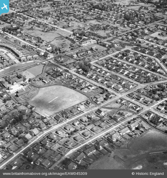
EAW045309 ENGLAND (1952). Housing around Craven Avenue, Long Road and Beverley Avenue, Canvey Island, 1952
© Copyright OpenStreetMap contributors and licensed by the OpenStreetMap Foundation. 2024. Cartography is licensed as CC BY-SA.
Nearby Images (10)
EAW045309

EAW051026

EAW045310

EAW051027

EAW045308

EAW045333

EAW021068

EAW026931

EAW048238

EAW045332

Details
| Title | [EAW045309] Housing around Craven Avenue, Long Road and Beverley Avenue, Canvey Island, 1952 |
| Reference | EAW045309 |
| Date | 2-August-1952 |
| Link | |
| Place name | CANVEY ISLAND |
| Parish | CANVEY ISLAND |
| District | |
| Country | ENGLAND |
| Easting / Northing | 579088, 183145 |
| Longitude / Latitude | 0.58152377803544, 51.518311396902 |
| National Grid Reference | TQ791831 |
Pins
Be the first to add a comment to this image!


