
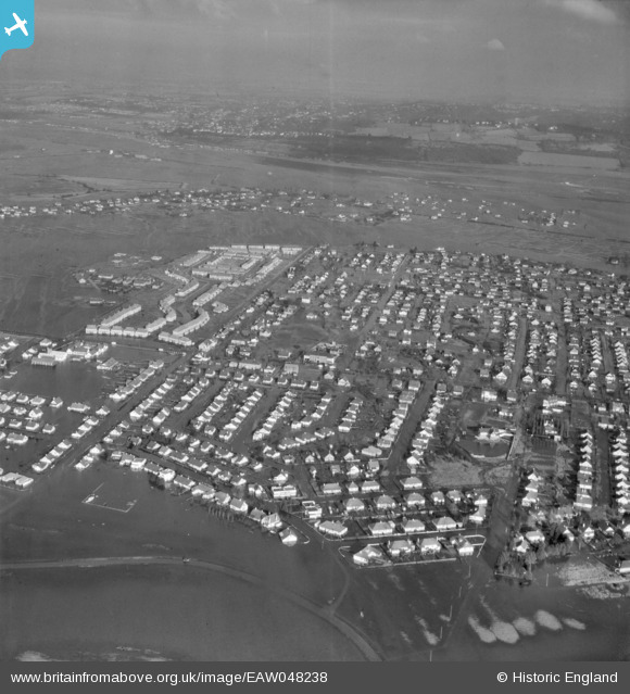
EAW048238 ENGLAND (1953). Flooding around Long Road, Canvey Island, from the south-east, 1953
© Copyright OpenStreetMap contributors and licensed by the OpenStreetMap Foundation. 2024. Cartography is licensed as CC BY-SA.
Nearby Images (8)
EAW048238

EAW045308

EAW045307

EAW051025

EAW051026

EAW045333

EAW045309

EAW021068

Details
| Title | [EAW048238] Flooding around Long Road, Canvey Island, from the south-east, 1953 |
| Reference | EAW048238 |
| Date | 2-February-1953 |
| Link | |
| Place name | CANVEY ISLAND |
| Parish | CANVEY ISLAND |
| District | |
| Country | ENGLAND |
| Easting / Northing | 579307, 183034 |
| Longitude / Latitude | 0.58462069565038, 51.517244769671 |
| National Grid Reference | TQ793830 |
Pins
Be the first to add a comment to this image!


