
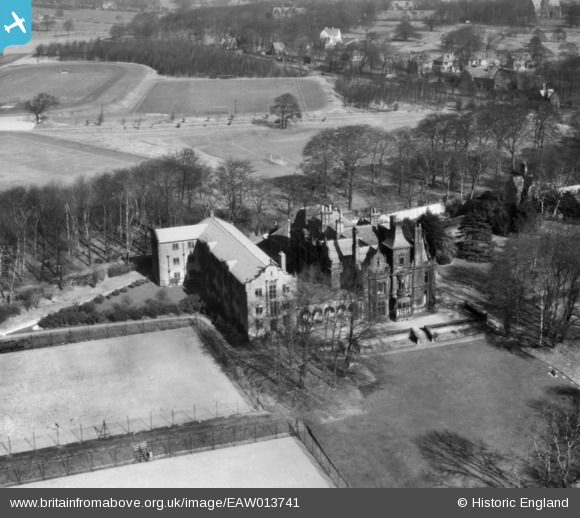
EAW013741 ENGLAND (1948). Oxley Hall, Weetwood, 1948. This image has been produced from a print.
© Copyright OpenStreetMap contributors and licensed by the OpenStreetMap Foundation. 2025. Cartography is licensed as CC BY-SA.
Nearby Images (10)
EAW013741

EAW013732

EAW013735

EAW013737

EAW013736

EAW013738

EAW013742

EAW013731

EAW013733

EAW013739

Details
| Title | [EAW013741] Oxley Hall, Weetwood, 1948. This image has been produced from a print. |
| Reference | EAW013741 |
| Date | 11-March-1948 |
| Link | |
| Place name | WEETWOOD |
| Parish | |
| District | |
| Country | ENGLAND |
| Easting / Northing | 427237, 437819 |
| Longitude / Latitude | -1.5860692590483, 53.83570094611 |
| National Grid Reference | SE272378 |
Pins
Be the first to add a comment to this image!