
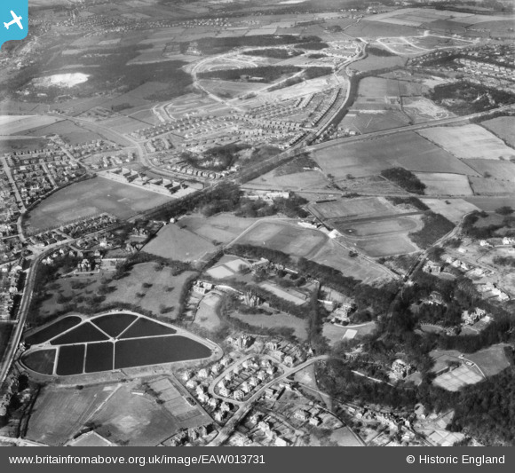
EAW013731 ENGLAND (1948). Weetwood Hall, Oxley Hall, Bardon Grange and surroundings, Weetwood, 1948
© Copyright OpenStreetMap contributors and licensed by the OpenStreetMap Foundation. 2025. Cartography is licensed as CC BY-SA.
Nearby Images (6)
EAW013731

EAW013733

EAW013734

EAW013739

EAW013740

EAW013741

Details
| Title | [EAW013731] Weetwood Hall, Oxley Hall, Bardon Grange and surroundings, Weetwood, 1948 |
| Reference | EAW013731 |
| Date | 11-March-1948 |
| Link | |
| Place name | WEETWOOD |
| Parish | |
| District | |
| Country | ENGLAND |
| Easting / Northing | 427045, 437957 |
| Longitude / Latitude | -1.5889749246549, 53.836951420656 |
| National Grid Reference | SE270380 |
Pins

ACFE |
Tuesday 25th of August 2020 11:50:53 PM | |
|
Chris Thompson |
Friday 19th of August 2016 04:44:22 PM | |
|
Chris Thompson |
Friday 19th of August 2016 04:43:01 PM | |
|
Chris Thompson |
Friday 19th of August 2016 04:37:07 PM | |
|
Chris Thompson |
Friday 19th of August 2016 04:34:42 PM | |
|
Chris Thompson |
Friday 19th of August 2016 04:33:55 PM | |
|
Chris Thompson |
Friday 19th of August 2016 04:32:59 PM | |
|
Chris Thompson |
Friday 19th of August 2016 04:32:00 PM | |
|
Chris Thompson |
Friday 19th of August 2016 04:31:04 PM | |
|
Chris Thompson |
Friday 19th of August 2016 04:30:11 PM | |
|
Chris Thompson |
Friday 19th of August 2016 04:27:22 PM | |
|
Chris Thompson |
Friday 19th of August 2016 04:25:59 PM | |
|
trevorsboy |
Wednesday 9th of March 2016 08:02:41 PM | |
|
trevorsboy |
Wednesday 9th of March 2016 07:58:08 PM | |
|
trevorsboy |
Wednesday 9th of March 2016 07:56:20 PM |