
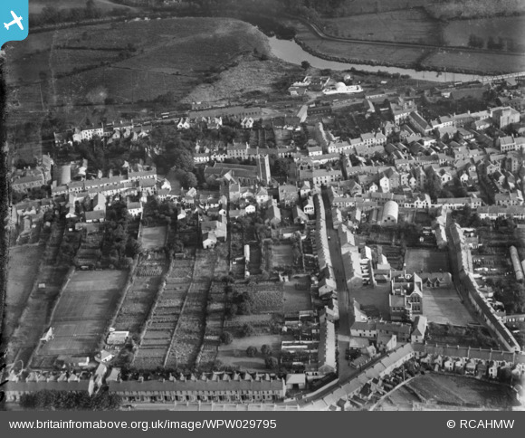
WPW029795 WALES (1929). View of Carmarthen, oblique aerial view. 5"x4" black and white glass plate negative.
© Copyright OpenStreetMap contributors and licensed by the OpenStreetMap Foundation. 2026. Cartography is licensed as CC BY-SA.
Nearby Images (5)
WAW039196

WPW029789

WPW029789A

WPW029795

WPW029796

Details
| Title | [WPW029795] View of Carmarthen, oblique aerial view. 5"x4" black and white glass plate negative. |
| Reference | WPW029795 |
| Date | 1929 |
| Link | Coflein Archive Item 6370646 |
| Place name | |
| Parish | |
| District | |
| Country | WALES |
| Easting / Northing | 241266, 219993 |
| Longitude / Latitude | -4.3051567721902, 51.855477647222 |
| National Grid Reference | SN413200 |
Pins

Esteve64 |
Saturday 16th of April 2016 02:58:44 PM | |
|
Esteve64 |
Saturday 16th of April 2016 02:57:22 PM | |
|
Esteve64 |
Saturday 16th of April 2016 02:56:04 PM | |

Class31 |
Sunday 2nd of August 2015 08:53:12 AM | |
|
Carmarthenshire Archive Service |
Friday 29th of June 2012 02:20:32 PM | |
|
Carmarthenshire Archive Service |
Friday 29th of June 2012 11:14:33 AM | |
|
Nigel Davies |
Tuesday 26th of June 2012 11:56:19 PM | |
|
Nigel Davies |
Tuesday 26th of June 2012 11:50:47 PM | |
|
Nigel Davies |
Tuesday 26th of June 2012 11:50:10 PM |

User Comment Contributions

Information Board, Carmarthen, 28/07/2015 |
Class31 |
Sunday 2nd of August 2015 08:55:10 AM |

St. Peter's Church, Carmarthen, 28/07/2015 |
Class31 |
Sunday 2nd of August 2015 08:47:48 AM |
Pre 1930 as the triangular group of buildings at the bottom right (known as Little Island) was demolished in 1930. |
Carmarthenshire Archive Service |
Friday 29th of June 2012 11:07:50 AM |