
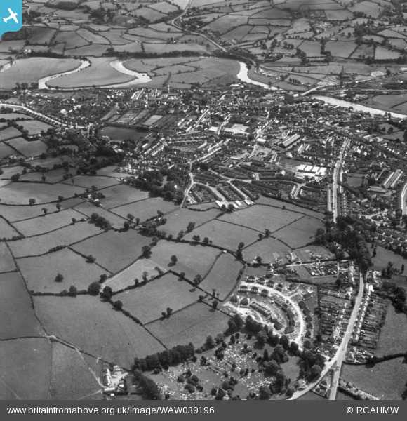
WAW039196 WALES (1951). General view of Carmarthen, showing cemetery and new housing at Heol Rudd in the foreground. Oblique aerial photograph, 5½" cut roll film.
© Copyright OpenStreetMap contributors and licensed by the OpenStreetMap Foundation. 2026. Cartography is licensed as CC BY-SA.
Nearby Images (5)
WAW039196

WPW029789

WPW029789A

WPW029795

WPW029796

Details
| Title | [WAW039196] General view of Carmarthen, showing cemetery and new housing at Heol Rudd in the foreground. Oblique aerial photograph, 5½" cut roll film. |
| Reference | WAW039196 |
| Date | 1951 |
| Link | Coflein Archive Item 6422561 |
| Place name | |
| Parish | |
| District | |
| Country | WALES |
| Easting / Northing | 241266, 219993 |
| Longitude / Latitude | -4.3051567721902, 51.855477647222 |
| National Grid Reference | SN413200 |
Pins

Luke83 |
Monday 30th of March 2020 02:32:57 PM | |
|
Luke83 |
Monday 30th of March 2020 02:25:07 PM | |
|
Luke83 |
Monday 30th of March 2020 02:22:47 PM | |
|
Doris |
Saturday 18th of November 2017 12:22:50 PM | |

Class31 |
Sunday 2nd of August 2015 08:02:08 PM | |
|
Class31 |
Sunday 2nd of August 2015 07:59:49 PM | |
|
Class31 |
Sunday 2nd of August 2015 07:58:09 PM |


