
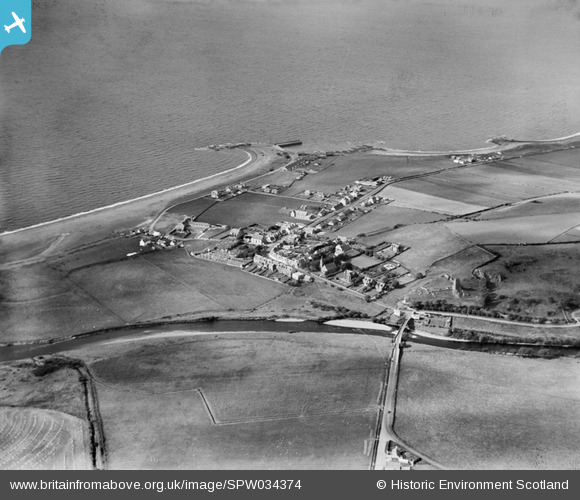
SPW034374 SCOTLAND (1930). Ballantrae, general view, showing Main Street and Ballantrae Bridge. An oblique aerial photograph taken facing north.
© Copyright OpenStreetMap contributors and licensed by the OpenStreetMap Foundation. 2025. Cartography is licensed as CC BY-SA.
Nearby Images (4)
SPW034374

SPW034382

SPW034373

SPW034375

Details
| Title | [SPW034374] Ballantrae, general view, showing Main Street and Ballantrae Bridge. An oblique aerial photograph taken facing north. |
| Reference | SPW034374 |
| Date | 1930 |
| Link | NRHE Collection item 1257100 |
| Place name | |
| Parish | BALLANTRAE (KYLE AND CARRICK) |
| District | KYLE AND CARRICK |
| Country | SCOTLAND |
| Easting / Northing | 208373, 582577 |
| Longitude / Latitude | -5.0039179599475, 55.100457391795 |
| National Grid Reference | NX084826 |
Pins

Billy Turner |
Tuesday 24th of November 2015 09:39:30 PM | |
 |
Billy Turner |
Tuesday 24th of November 2015 09:06:05 PM |
 |
Billy Turner |
Tuesday 24th of November 2015 08:45:38 PM |
|
Billy Turner |
Tuesday 24th of November 2015 08:23:10 PM | |
 |
Billy Turner |
Tuesday 24th of November 2015 07:55:37 PM |

Class31 |
Monday 13th of August 2012 11:02:18 PM |
