
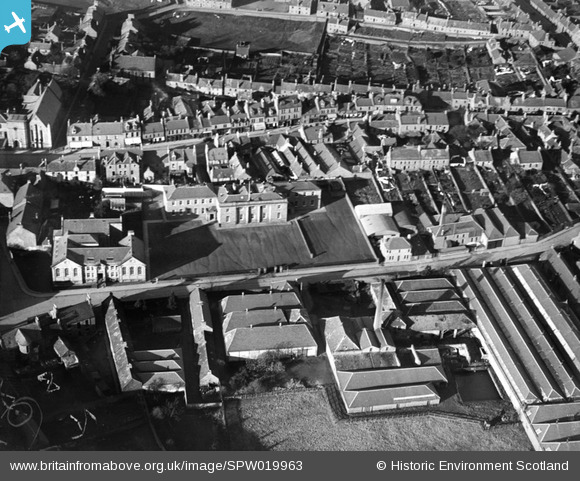
SPW019963 SCOTLAND (1927). Forfar, general view, showing Chapelpark Primary School and Academy Street. An oblique aerial photograph taken facing north.
© Copyright OpenStreetMap contributors and licensed by the OpenStreetMap Foundation. 2026. Cartography is licensed as CC BY-SA.
Nearby Images (4)
SPW019963

SPW019961

SPW019965

SPW019966

Details
| Title | [SPW019963] Forfar, general view, showing Chapelpark Primary School and Academy Street. An oblique aerial photograph taken facing north. |
| Reference | SPW019963 |
| Date | 1927 |
| Link | NRHE Collection item 1246365 |
| Place name | |
| Parish | FORFAR |
| District | ANGUS |
| Country | SCOTLAND |
| Easting / Northing | 345920, 750659 |
| Longitude / Latitude | -2.881950469785, 56.644742702986 |
| National Grid Reference | NO459507 |
Pins
Be the first to add a comment to this image!