
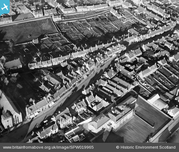
SPW019965 SCOTLAND (1927). Forfar, general view, showing East High Street and Chapelpark Primary School. An oblique aerial photograph taken facing north.
© Copyright OpenStreetMap contributors and licensed by the OpenStreetMap Foundation. 2026. Cartography is licensed as CC BY-SA.
Nearby Images (3)
SPW019961

SPW019965

SPW019963

Details
| Title | [SPW019965] Forfar, general view, showing East High Street and Chapelpark Primary School. An oblique aerial photograph taken facing north. |
| Reference | SPW019965 |
| Date | 1927 |
| Link | NRHE Collection item 1246367 |
| Place name | |
| Parish | FORFAR |
| District | ANGUS |
| Country | SCOTLAND |
| Easting / Northing | 345932, 750749 |
| Longitude / Latitude | -2.8817736635482, 56.645552626014 |
| National Grid Reference | NO459507 |
Pins
Be the first to add a comment to this image!