
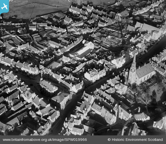
SPW019966 SCOTLAND (1927). Forfar, general view, showing East High Street with Forfar Parish Church and Town Hall. An oblique aerial photograph taken facing north-east.
© Copyright OpenStreetMap contributors and licensed by the OpenStreetMap Foundation. 2026. Cartography is licensed as CC BY-SA.
Nearby Images (7)
SPW019966

SAR023882

SPW019987

SAW035393

SAW039081

SPW019964

SPW019963

Details
| Title | [SPW019966] Forfar, general view, showing East High Street with Forfar Parish Church and Town Hall. An oblique aerial photograph taken facing north-east. |
| Reference | SPW019966 |
| Date | 1927 |
| Link | NRHE Collection item 1246368 |
| Place name | |
| Parish | FORFAR |
| District | ANGUS |
| Country | SCOTLAND |
| Easting / Northing | 345677, 750656 |
| Longitude / Latitude | -2.8859122089589, 56.64468761822 |
| National Grid Reference | NO457507 |
Pins
Be the first to add a comment to this image!