
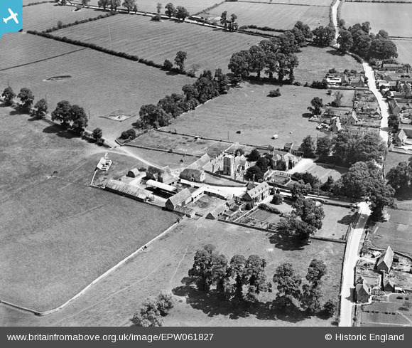
EPW061827 ENGLAND (1939). Preston Farm and All Saints' Church, Preston, 1939
© Copyright OpenStreetMap contributors and licensed by the OpenStreetMap Foundation. 2025. Cartography is licensed as CC BY-SA.
Nearby Images (7)
EPW061827

EPW061824

EPW061813

EPW061811

EPW061814

EPW061822

EPW061820

Details
| Title | [EPW061827] Preston Farm and All Saints' Church, Preston, 1939 |
| Reference | EPW061827 |
| Date | 8-June-1939 |
| Link | |
| Place name | PRESTON |
| Parish | PRESTON |
| District | |
| Country | ENGLAND |
| Easting / Northing | 404393, 200912 |
| Longitude / Latitude | -1.9364181136424, 51.706469486347 |
| National Grid Reference | SP044009 |
Pins
Be the first to add a comment to this image!