
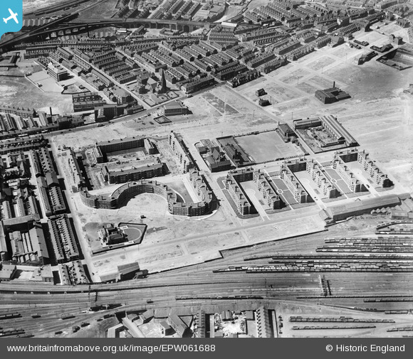
EPW061688 ENGLAND (1939). The Corporation flats, Collyhurst, 1939
© Copyright OpenStreetMap contributors and licensed by the OpenStreetMap Foundation. 2026. Cartography is licensed as CC BY-SA.
Nearby Images (6)
EPW061688

EPW061686

EPW061687

EPW061689

EPW061690

EPW061685

Details
| Title | [EPW061688] The Corporation flats, Collyhurst, 1939 |
| Reference | EPW061688 |
| Date | 4-June-1939 |
| Link | |
| Place name | COLLYHURST |
| Parish | |
| District | |
| Country | ENGLAND |
| Easting / Northing | 385619, 400036 |
| Longitude / Latitude | -2.2168052848482, 53.496578986673 |
| National Grid Reference | SD856000 |
Pins
Be the first to add a comment to this image!