
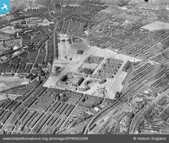
EPW061686 ENGLAND (1939). The Corporation flats and the surrounding residential area, Collyhurst, 1939
© Copyright OpenStreetMap contributors and licensed by the OpenStreetMap Foundation. 2026. Cartography is licensed as CC BY-SA.
Nearby Images (6)
EPW061686

EPW061687

EPW061685

EPW061688

EPW061689

EPW061690

Details
| Title | [EPW061686] The Corporation flats and the surrounding residential area, Collyhurst, 1939 |
| Reference | EPW061686 |
| Date | 4-June-1939 |
| Link | |
| Place name | COLLYHURST |
| Parish | |
| District | |
| Country | ENGLAND |
| Easting / Northing | 385621, 400115 |
| Longitude / Latitude | -2.2167787555709, 53.497289204101 |
| National Grid Reference | SD856001 |
Pins
Be the first to add a comment to this image!