
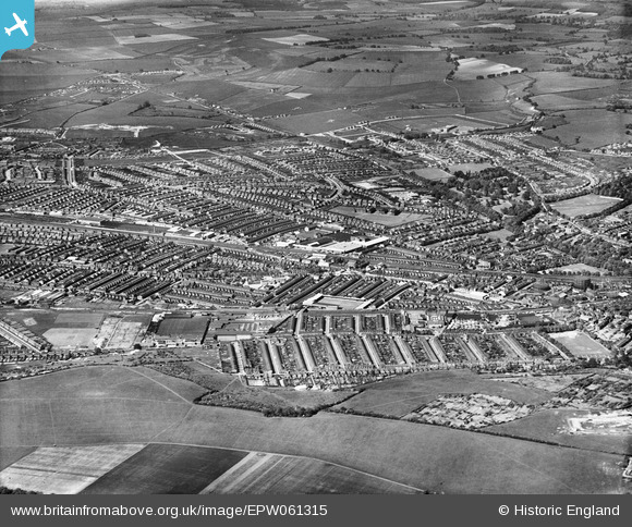
EPW061315 ENGLAND (1939). Winsdon Hill, Bury Park and Biscot, Luton, from the south-west, 1939
© Copyright OpenStreetMap contributors and licensed by the OpenStreetMap Foundation. 2026. Cartography is licensed as CC BY-SA.
Nearby Images (13)
EPW061315

EAW016042

EPW037362

EPW037364

EPW037361

EPW037363

EPW037357

EPW037360

EPW037359

EPW037365

EPW037358

EPW026488

EPW037366

Details
| Title | [EPW061315] Winsdon Hill, Bury Park and Biscot, Luton, from the south-west, 1939 |
| Reference | EPW061315 |
| Date | 2-June-1939 |
| Link | |
| Place name | LUTON |
| Parish | |
| District | |
| Country | ENGLAND |
| Easting / Northing | 507852, 221479 |
| Longitude / Latitude | -0.43292571080057, 51.88099117955 |
| National Grid Reference | TL079215 |
Pins

Jimmy |
Wednesday 1st of July 2015 10:24:38 AM |