
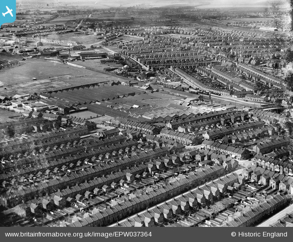
EPW037364 ENGLAND (1932). The Davis Gas Stove Co Diamond Foundry and surrounding housing, Luton, 1932
© Copyright OpenStreetMap contributors and licensed by the OpenStreetMap Foundation. 2026. Cartography is licensed as CC BY-SA.
Nearby Images (13)
EPW037364

EPW037363

EPW037362

EPW037357

EPW037360

EPW037358

EPW037359

EPW037361

EPW037365

EPW037366

EPW061315

EPW019307

EAW016042

Details
| Title | [EPW037364] The Davis Gas Stove Co Diamond Foundry and surrounding housing, Luton, 1932 |
| Reference | EPW037364 |
| Date | 13-April-1932 |
| Link | |
| Place name | LUTON |
| Parish | |
| District | |
| Country | ENGLAND |
| Easting / Northing | 507789, 221676 |
| Longitude / Latitude | -0.43377917325688, 51.882774110052 |
| National Grid Reference | TL078217 |
