
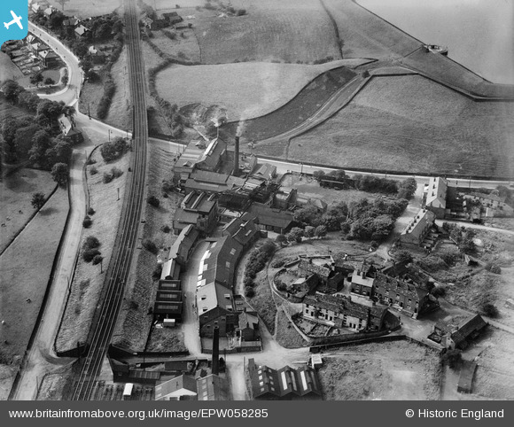
EPW058285 ENGLAND (1938). The Wall's Ice Cream Factory and environs, Godley Hill, 1938
© Copyright OpenStreetMap contributors and licensed by the OpenStreetMap Foundation. 2026. Cartography is licensed as CC BY-SA.
Nearby Images (7)
EPW058285

EPW058284

EPW058287

EPW058289

EPW058288

EPW058283

EPW058286

Details
| Title | [EPW058285] The Wall's Ice Cream Factory and environs, Godley Hill, 1938 |
| Reference | EPW058285 |
| Date | 22-July-1938 |
| Link | |
| Place name | GODLEY HILL |
| Parish | |
| District | |
| Country | ENGLAND |
| Easting / Northing | 396602, 394969 |
| Longitude / Latitude | -2.0511729812668, 53.451214835142 |
| National Grid Reference | SJ966950 |
Pins
Be the first to add a comment to this image!