
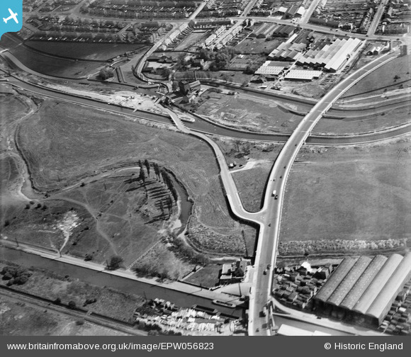
EPW056823 ENGLAND (1938). The junction of Lower Hall Lane and the North Circular Road, Edmonton, 1938
© Copyright OpenStreetMap contributors and licensed by the OpenStreetMap Foundation. 2026. Cartography is licensed as CC BY-SA.
Nearby Images (24)
EPW056823

EPW056816

EPW052271

EPW056321

EPW052282

EPW058457

EPW050859

EPW058467

EPW056320

EPW056818

EPW053837

EPW049529

EPW049703

EPW055981

EPW018565

EPW018567

EPW053836

EPW018568

EPW055980

EPW052287

EPW018561

EPW018563

EPW018562

EPW018569

Details
| Title | [EPW056823] The junction of Lower Hall Lane and the North Circular Road, Edmonton, 1938 |
| Reference | EPW056823 |
| Date | 11-April-1938 |
| Link | |
| Place name | EDMONTON |
| Parish | |
| District | |
| Country | ENGLAND |
| Easting / Northing | 536069, 192376 |
| Longitude / Latitude | -0.034559344145843, 51.613276045973 |
| National Grid Reference | TQ361924 |
Pins
Be the first to add a comment to this image!