
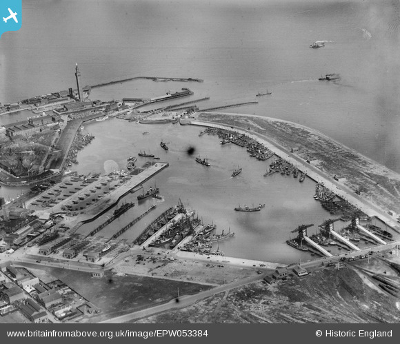
EPW053384 ENGLAND (1937). Grimsby Docks, Grimsby, 1937
© Copyright OpenStreetMap contributors and licensed by the OpenStreetMap Foundation. 2026. Cartography is licensed as CC BY-SA.
Nearby Images (5)
EPW053384

EAW040600

EAW029008

EPW053394

EAW029005

Details
| Title | [EPW053384] Grimsby Docks, Grimsby, 1937 |
| Reference | EPW053384 |
| Date | 31-May-1937 |
| Link | |
| Place name | GRIMSBY |
| Parish | |
| District | |
| Country | ENGLAND |
| Easting / Northing | 528343, 411014 |
| Longitude / Latitude | -0.061221410452993, 53.579751315632 |
| National Grid Reference | TA283110 |


