
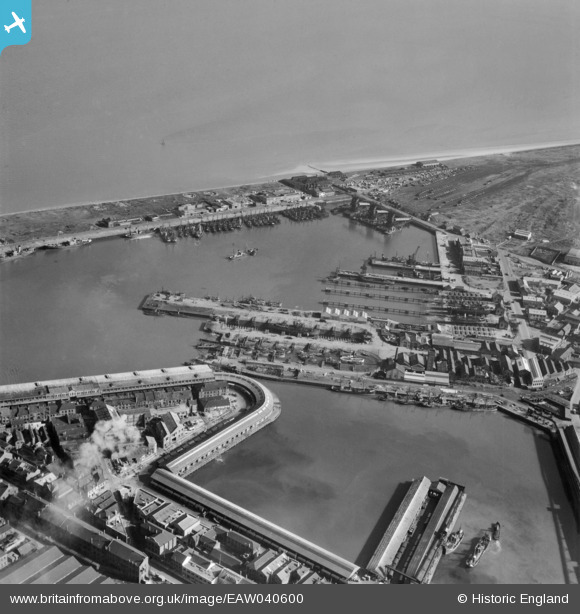
EAW040600 ENGLAND (1951). The Fish Docks, Grimsby, 1951
© Copyright OpenStreetMap contributors and licensed by the OpenStreetMap Foundation. 2026. Cartography is licensed as CC BY-SA.
Nearby Images (8)
EAW040600

EPW053384

EPW053394

EAW029005

EAW029006

EAW029008

EAW029009

EAW029010

Details
| Title | [EAW040600] The Fish Docks, Grimsby, 1951 |
| Reference | EAW040600 |
| Date | 8-October-1951 |
| Link | |
| Place name | GRIMSBY |
| Parish | |
| District | |
| Country | ENGLAND |
| Easting / Northing | 528327, 410892 |
| Longitude / Latitude | -0.061513119683231, 53.578659159373 |
| National Grid Reference | TA283109 |
Pins

redmist |
Wednesday 31st of October 2018 09:41:28 PM |
User Comment Contributions
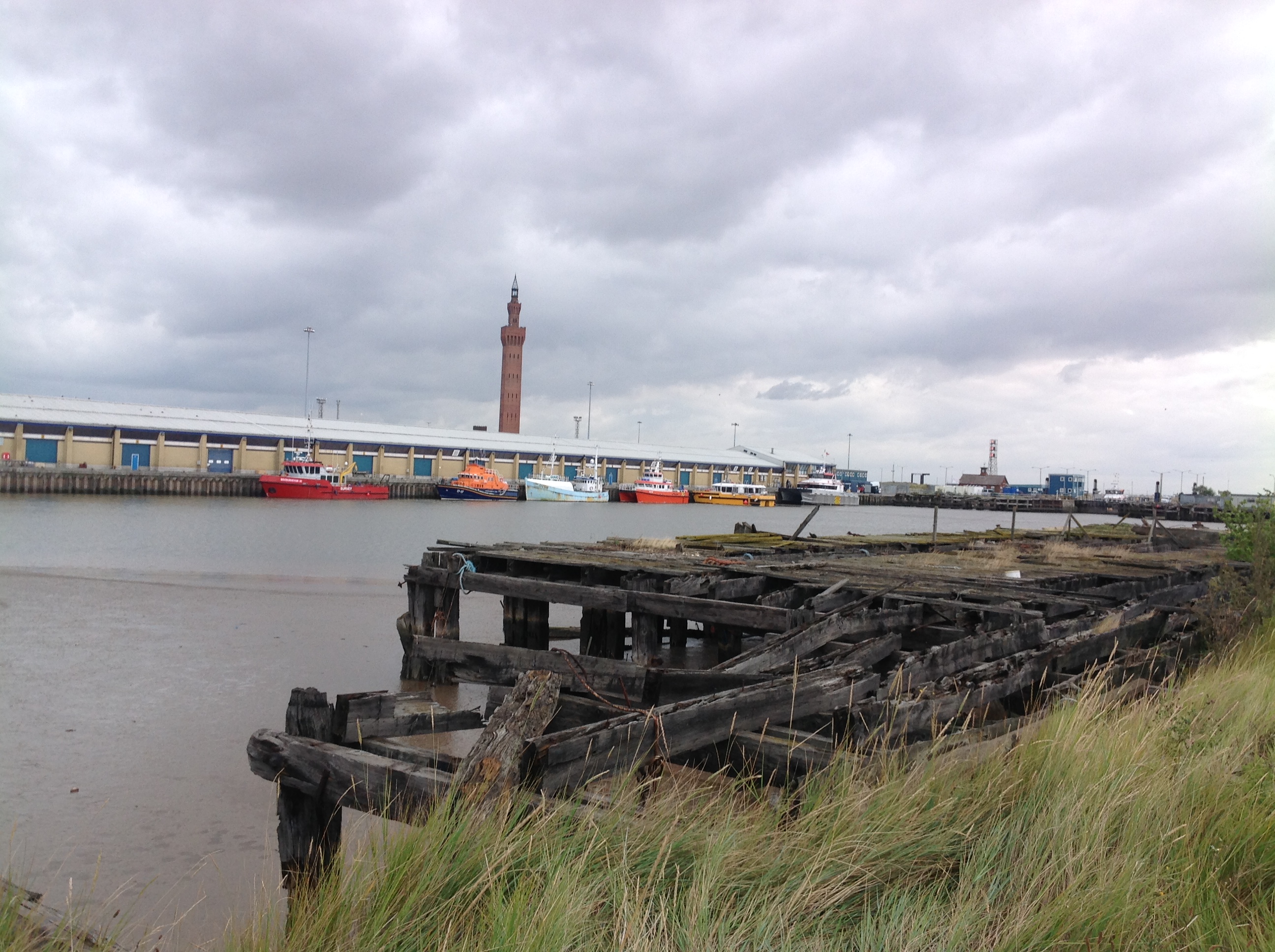
Fish Dock, Grimsby, 29/08/2014 |

Class31 |
Wednesday 11th of May 2016 10:36:43 AM |