
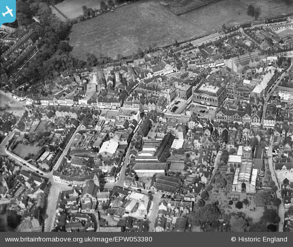
EPW053380 ENGLAND (1937). The Shire Hall, Gaolgate Street and the town centre, Stafford, 1937
© Copyright OpenStreetMap contributors and licensed by the OpenStreetMap Foundation. 2026. Cartography is licensed as CC BY-SA.
Nearby Images (23)
EPW053380

EPW053381

EAW001867

EAW001865

EPW014106

EPW020050

EAW001866

EAW024958

EPW034022

EPW014109

EAW024955

EPW053375

EAW024954

EPW014113

EPW017027

EAW024968

EAW024967

EAW046078

EAW024965

EAW024962
, Stafford, 1949. This image has been produced from a damaged negative.")
EAW024963

EAW024964

EAW024961
, Stafford, 1949. This image has been produced from a damaged negative.")
Details
| Title | [EPW053380] The Shire Hall, Gaolgate Street and the town centre, Stafford, 1937 |
| Reference | EPW053380 |
| Date | 30-May-1937 |
| Link | |
| Place name | STAFFORD |
| Parish | |
| District | |
| Country | ENGLAND |
| Easting / Northing | 392148, 323331 |
| Longitude / Latitude | -2.1164941463305, 52.807141425473 |
| National Grid Reference | SJ921233 |
Pins
Be the first to add a comment to this image!
User Comment Contributions

Shire Hall,12/08/2015 |

Class31 |
Wednesday 12th of August 2015 10:44:20 PM |