
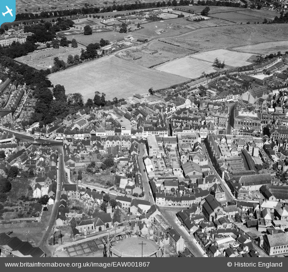
EAW001867 ENGLAND (1946). Gaolgate Street, Stafford, 1946
© Copyright OpenStreetMap contributors and licensed by the OpenStreetMap Foundation. 2026. Cartography is licensed as CC BY-SA.
Nearby Images (22)
EAW001867

EPW020050

EPW053380

EPW053381

EPW014106

EAW001865

EAW001866

EAW024958

EPW034022

EAW024967

EPW017027

EAW024968

EPW014109

EPW014113

EAW024955

EAW024954

EAW024965

EAW024963

EAW024964

EAW024962
, Stafford, 1949. This image has been produced from a damaged negative.")
EAW024961
, Stafford, 1949. This image has been produced from a damaged negative.")
EAW024966

Details
| Title | [EAW001867] Gaolgate Street, Stafford, 1946 |
| Reference | EAW001867 |
| Date | 12-July-1946 |
| Link | |
| Place name | STAFFORD |
| Parish | |
| District | |
| Country | ENGLAND |
| Easting / Northing | 392146, 323405 |
| Longitude / Latitude | -2.1165255974257, 52.807806692678 |
| National Grid Reference | SJ921234 |
Pins

AJ |
Sunday 8th of September 2013 11:20:52 PM |