
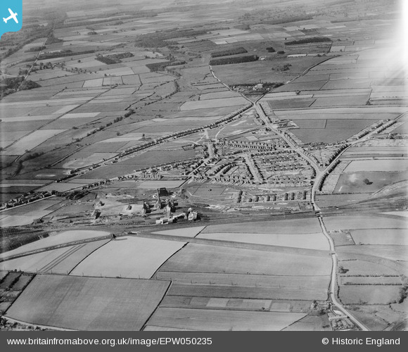
EPW050235 ENGLAND (1936). The Ollerton Colliery, housing at New Ollerton and surrounding countryside, Ollerton, 1936
© Copyright OpenStreetMap contributors and licensed by the OpenStreetMap Foundation. 2026. Cartography is licensed as CC BY-SA.
Nearby Images (4)
EPW050235

EPW050237

EPW050231

EPW050230

Details
| Title | [EPW050235] The Ollerton Colliery, housing at New Ollerton and surrounding countryside, Ollerton, 1936 |
| Reference | EPW050235 |
| Date | May-1936 |
| Link | |
| Place name | OLLERTON |
| Parish | OLLERTON AND BOUGHTON |
| District | |
| Country | ENGLAND |
| Easting / Northing | 466435, 367843 |
| Longitude / Latitude | -1.0052773245485, 53.203218973827 |
| National Grid Reference | SK664678 |
Pins
Be the first to add a comment to this image!