
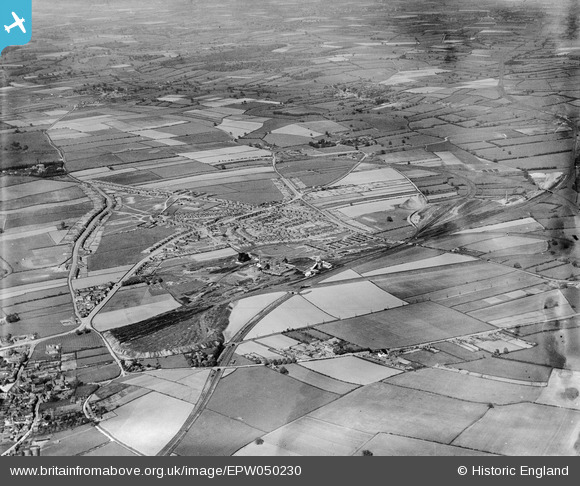
EPW050230 ENGLAND (1936). The Ollerton Colliery, housing at New Ollerton and surrounding countryside, Ollerton, 1936
© Copyright OpenStreetMap contributors and licensed by the OpenStreetMap Foundation. 2026. Cartography is licensed as CC BY-SA.
Nearby Images (8)
EPW050230

EPW050232

EPW050231

EPW050234

EPW050235

EPW050238

EPW050236

EPW050233

Details
| Title | [EPW050230] The Ollerton Colliery, housing at New Ollerton and surrounding countryside, Ollerton, 1936 |
| Reference | EPW050230 |
| Date | May-1936 |
| Link | |
| Place name | OLLERTON |
| Parish | OLLERTON AND BOUGHTON |
| District | |
| Country | ENGLAND |
| Easting / Northing | 466655, 367716 |
| Longitude / Latitude | -1.0020103598391, 53.202049888827 |
| National Grid Reference | SK667677 |
Pins

Graham Bryan |
Saturday 23rd of May 2015 10:01:35 PM |