
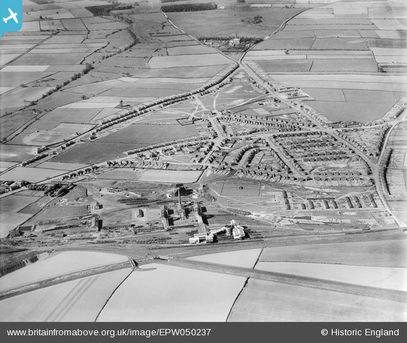
EPW050237 ENGLAND (1936). The Ollerton Colliery and housing at New Ollerton, Ollerton, 1936
© Copyright OpenStreetMap contributors and licensed by the OpenStreetMap Foundation. 2026. Cartography is licensed as CC BY-SA.
Nearby Images (5)
EPW050237

EPW050235

EPW050231

EPW050236

EPW050233

Details
| Title | [EPW050237] The Ollerton Colliery and housing at New Ollerton, Ollerton, 1936 |
| Reference | EPW050237 |
| Date | May-1936 |
| Link | |
| Place name | OLLERTON |
| Parish | OLLERTON AND BOUGHTON |
| District | |
| Country | ENGLAND |
| Easting / Northing | 466387, 367778 |
| Longitude / Latitude | -1.0060094231944, 53.202640714234 |
| National Grid Reference | SK664678 |
