
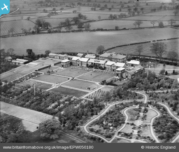
EPW050180 ENGLAND (1936). The NATSOPA Memorial Home, Wellsborough, 1936
© Copyright OpenStreetMap contributors and licensed by the OpenStreetMap Foundation. 2026. Cartography is licensed as CC BY-SA.
Nearby Images (25)
EPW050180

EPW050166

EPW050176

EPW050173

EPW050178

EPW050168

EAW025252
 Memorial Home, Wellsborough, from the south-east, 1949")
EPW050169

EPW050175

EPW050167

EAW025253
 Memorial Home, Wellsborough, from the north-west, 1949")
EPW050174

EPW050179

EAW025251
 Memorial Home, Wellsborough, from the north-west, 1949")
EPW050177

EPW050165

EAW025255
 Memorial Home and environs, Wellsborough, from the south-west, 1949")
EAW025247
 Memorial Home, Wellsborough, from the south-east, 1949")
EAW025257
 Memorial Home, Wellsborough, from the south-west, 1949")
EAW025250
 Memorial Home, Wellsborough, from the south-east, 1949")
EAW025256
 Memorial Home, Wellsborough, from the south-west, 1949")
EAW025254
 Memorial Home and environs, Wellsborough, from the south-west, 1949")
EPW050172

EAW025248
 Memorial Home, Wellsborough, 1949")
EPW050171

Details
| Title | [EPW050180] The NATSOPA Memorial Home, Wellsborough, 1936 |
| Reference | EPW050180 |
| Date | May-1936 |
| Link | |
| Place name | WELLSBOROUGH |
| Parish | SHEEPY |
| District | |
| Country | ENGLAND |
| Easting / Northing | 436062, 302306 |
| Longitude / Latitude | -1.467294940866, 52.616972443055 |
| National Grid Reference | SK361023 |
Pins
Be the first to add a comment to this image!